2018 November: Byangee Mountain, Morton National Park (commonly known as the Budawangs), NSW, Australia
Day-trip
Prolog - Byangee Mountain
Byangee Mountain is the flat top mountain dominating the pic below. It is in NSW Morton National Park ... That area is commonly known as the Budawangs.

... which is what we'll do today ... along the yellow arrows.
(Red arrow: Pigeon House)
The above pic was taken from the top of The Castle.
Photos and trip report to The Castle are in my blog:
http://mntviews.blogspot.com/2016/04/the-castle-nsw-morton-nat-pk-australia.html
(I went there 2 and a half years ago in 2016 April.)
This trip
3 of us: Frank, David and I.
Book
"Bushwalking in the Budawangs" by Ron Doughton, 3rd edition, 2004
(Published by: Envirobook)
Chapter 4 ("Long Gully - Castle Gap - Byangee Mountain - return") has a great description on how to climb this mountain.
Maps
1:25,000 scaled Corang 8927-3N
Below is the relevant part of the 1:25,000 scaled map.

GPS tracklog file & Route
The GPX tracklog file of our walk can be downloaded from:
https://drive.google.com/open?id=1bE2yKPyGsZzcf9WR0-4_FfaLzzlSoh8-
Below is our tracklog in red superimposed on the 1:25,000 map.
- Insert at top of the map:
3 black arrows from top to bottom:
1 Tall rock pillar ... photo #24
2 "Pillar Box"... photo #28
3 Tunnel ... photos #36 and #37
- 6 dark brown arrows, left to right and top to bottom:
1 Cathedral Cave
2 Lookout 1 ... photos #43 to #45
3 Logbook
4 Lookout 4 ... photo #78
5 Lookout 3 ... photos #74 and #75
6 Lookout 2 ... photos #71 to #73

On the return leg, we were wiser. We walked along the cliff edges, passing lookouts 2 and 3 ... much easier walking that way :-)
Satellite image of the above map:

Summary of our route:
- Start from Long Gully Campground by the south bank of Yadboro River, Budawang National Park.
- Cross Yadboro River into Morton National Park
- Walk on Byangee Trail to Castle Gap.
- Then to the north-western side of Byangee Mountain.
- Climb up the cliffs to the plateau.
- To logbook box.
- Then to Pickering Point ... our ultimate destination
- Return to car.
Timeline & Distance
07:10 0.0 km Start walking from Long Gully Campground
07:54 2.4 km At where firetrail ends; and the start of a foot track
07:58 2.4 km Resume walking
08:19 2.8 km At Cathedral Cave
Inside the cave
08:23 2.85km Out of Cathedral Cave
08:33 3.15km Stop for morning tea
Morning Tea
08:45 3.25km Resume walking
09:00 3.7 km At midpoint of Castle Gap
09:16 4.3 km At where we'll climb up the cliffs of Byangee Mountain
Visit a tall rock pillar (a hoodoo) further east
09:25 4.5 km Start to climb up the cliffs of Byangee Mountain
10:00 5.0 km Finish climbing up the cliffs of Byangee Mountain, now at its plateau
10:08 5.05km Resume walking
10:20 5.65km At a lookout 1, a rocky lookout by cliff edge
10:22 5.65km Resume walking
10:26 5.8 km At where the logbook is kept
Sign logbook
10:32 5.85km Resume walking
12:31 9.05km Stop for lunch
Lunch
12:52 9.1 km Resume walking
12:55 9.2 km At Pickering Point
13:17 9.35km Resume walking, heading to lookout 2
13:31 9.75km At lookout 2
13:34 9.8 km Turn north, heading back to carpark
14:24 11.05km Stop for afternoon tea
Afternoon tea #1
14:36 11.05km Resume walking
15:20 12.75km At where the logbook is kept
15:37 13.55km At where we'll soon go down Byangee Mountain; same spot as at 10:00
Afternoon tea #2
15:44 13.6 km Start to go down Byangee Mountain
16:15 14.0 km Finish climbing down the cliffs Byangee Mountain; same spot as at 09:16
Start to head towards Castle Gap
16:26 14.5 km Stop for a rest
Rest
16:29 14.55km Resume walking
16:32 14.7 km At midpoint of Castle Gap
17:07 15.65km Stop for a rest
Rest
17:14 15.65km Resume walking
17:18 15.8 km At firetrail; same spot as at 07:54
17:55 18.25km Back at Long Gully Campground
==============================================
Total: 10 hrs 45 mins
18.25 km Distance is from Google Earth
Pictures - Long Gully Campground
Starting point of our walk is Long Gully Campground by the south bank of Yadboro River, Budawang National Park.
1) We are on our way to Byangee Mountain ... now looking back at Long Gully Campground.
- Yellow arrow: Direction of walk to the mountain
- David and I camped at the campground the night before. His car is on the left.
- Frank's car is on the right. He arrived from Kiama early this morning.

Yadboro River
2) First thing is to cross Yadboro River from Budawang National Park to Morton National Park. Yadboro River forms the boundary between the two National Parks.
- Upper pic: Left to right: David, Frank
- Lower pic: Frank ... Photograph taken in the afternoon on the return leg

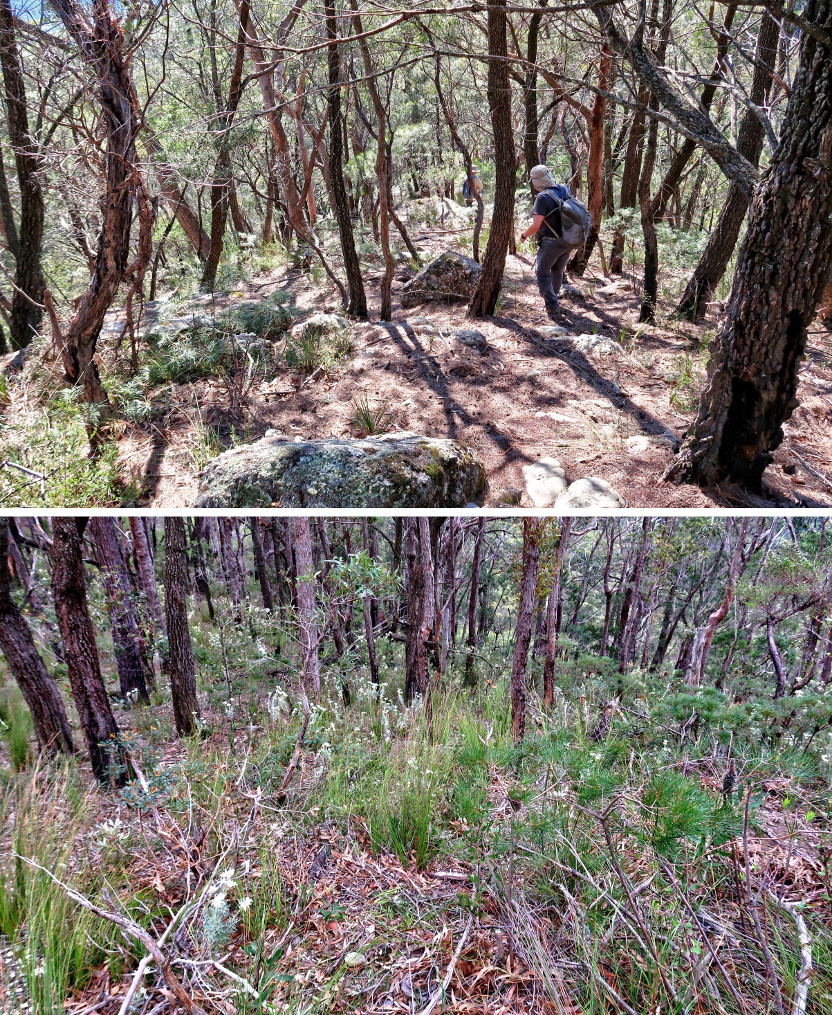
Byangee Trail
3) After crossing Yadboro River, Frank leads us along Byangee Trail.
- Upper left: Initially Byangee Trail is a firetrail.
- Upper right: When close to the cliffs of The Castle, the trail narrows.
- Lower pics: When closer still to the cliffs, it becomes an indistinct rough foot track.

4) The southern most tip of The Castle escarpment
- Yellow arrows: Our route along an indistinct rough foot track

Along base of escarpment of The Castle
Then it is to Castle Gap by walking along the base of the cliffs on the south side of The Castle.
(Castle Gap is the saddle between The Castle and Byangee Mountain.)
5) Plenty of caves along the cliffs ~~~
This whole area used to be under the sea. It is subsequently lifted up above the water. Hence the rocks here are sedimentary rocks called Conglomerate.
- Upper pic: One of the caves
- Lower pic: This photograph is taken much later ... after passing Cathedral Cave (photos #7 to #10)

6) The walk is not easy, plenty of awkward scrambles.

Cathedral Cave
7) We come to Cathedral Cave. Actually it is more like a tunnel rather than a cave, as you enter from one opening and exit out of the opposite side.
(You need to do a slight detour to reach the cave. On the return leg, we'll bypass it.)
- Left pic: Entrance into the cave ... you can see Frank has already ducked in.
- Right pic: Inside the cave and looking back at the entrance

8) Inside Cathedral Cave ~~~
- Upper pic: David is entering the cave ... more like dropping into the cave :-)
- Lower pic: left to right: David, Frank

9) We exit the cave this way.

10) The 2 pics below are taken at the same spot, just outside Cathedral Cave ~~~
- Upper pic: Looking back at the cave
- Lower pic: Facing forward ... Frank is leading

To Castle Gap
Continuing towards Castle Gap along the base of the cliffs on the south side of The Castle ...
11) ... We come to a tree (white oval) with interesting branches.
Morning tea is near this tree.

12) Continuing along the base of the cliffs on the south side of The Castle

13) Caves along the base of the cliffs on the south side of The Castle

14) More caves

Castle Gap
15) At western end of Castle Gap, looking back at the south-eastern tip of the escarpment of The Castle

16) Walking along Castle Gap towards Byangee Mountain ~~~
- Upper pic: David is in front
- Lower pic: At this time of the year, an abundance of white Flannel Flowers around this area.
17) Closer look at the white Flannel Flowers, Actinotus helianthi

18) Some kind of Grass Tree ... which species ?

19) At the mid point of Castle Gap ~~~
- Looking forward (east) is Byangee Mountain, upper pic.
- Looking back (west) is The Castle, lower pic.

20) Looking back at The Castle from the eastern end of Castle Gap (ie from western tip of Byangee Mountain)

Escarpments at the north-western end of Byangee Mountain
We've passed Castle Gap ...
21) ... Now walking along the base of escarpments at the north-western end of Byangee Mountain.

22) Frank walking along the base of escarpments at the north-western end of Byangee Mountain

23) (Continuation to the right of previous pic)
The escarpments of Byangee Mountain is dotted with caves.

Tall rock pillar
We purposely walk pass the point to climb up the cliffs of Byangee Mountain, so that we can visit ...
24) ... So that we can visit this tall rock pillar.
The only other tall rock pillar in Australia that I'm aware of is the "Totem Pole" in Wollemi National Park, NSW. You can check out the photographs and trip report in this link:
http://mntviews.blogspot.com.au/2017/10/totem-pole-wollemi-nat-pk-nsw-australia.html

Climb up the cliffs of Byangee Mountain
From the tall rock pillar of the previous pic, back track for 50 meters to ...
25) ... to this point where will climb up the cliffs of Byangee Mountain ... Follow the yellow arrows.

26) Not long after climbing up (previous pic), we encounter a fixed rope to help us.
- Frank climbs up through the right side of the log. Next, I'll climb up through the left side.
- The red rope seems to be very new. I reckon had we been here a few week ago, the rope may not be here :-)
- Lower right pic: How the rope is anchored to a tree

27) After the red rope, comes 2 fixed yellow ropes.
- As usual, Frank is leading.

28) Then we come to a shorter rock pillar named as "Pillar Box" in Ron Doughton's book "Bushwalking in the Budawangs" ~~~
- It is formed from the same type of sedimentary rocks (called Conglomerate) as the "Totem Pole" in Wollemi National Park, NSW.
( Photographs and trip report of the "Totem Pole" in this link:
http://mntviews.blogspot.com.au/2017/10/totem-pole-wollemi-nat-pk-nsw-australia.html )

29) Then it is more steep climbing ... David is in action here.

30) Then another brand new red rope ~~~
- Frank demonstrates how to climb up the big boulder :-)

31) I have climbed up the big boulder, now watching David climbing up.
- The big boulder and the smaller rock in this pic are the same as the ones in the previous pic.

32) Immediately after the big boulder, there is another rock to climb up, with the assistance of 2 fixed ropes.
- In these pics, I'm watching David climbing up.

33) After the fixed ropes, still more steep scrambles ~~~
- Upper pics: Frank leading
- Lower pic: Looking back at David climbing up

Along ledge to tunnel
By now, we've done most of the hard climbing :-)
34) Impressive cliffs here ~~~
- Yellow arrow: Direction of our walk ... It is along a ledge, a respite from the steep scrambles of the previous pics :-)

35) Still walking along a ledge (heading towards a tunnel) ~~~
- Lower pic: As usual, Frank is leading.

Tunnel
36) A short tunnel formed by a big rock fallen on top of the end of a narrow passage up the cliffs.
- Left pic: This is taken in the afternoon on the return leg. A hiker in blue has gone inside.
- Right pic: In the morning, Frank is leading us into it.

37) At the other end of the tunnel, and looking back ~~~
- To exit the tunnel, One needs to climb up to the opening from inside.

At Byangee Mountain plateau
38) After the tunnel, some more gentler climbs, and we are up at the north-west part of the plateau of Byangee Mountain.

39) At the top of the rock of the previous pic ~~~
- The 2 pics below and photo #40 form a 360-degree panorama.
- Upper pic: Frank ... The Castle is the main feature in the background.
- Lower pic, left to right: David, me
• 2 red lines from left to right:
1 The Castle ... See my blog: http://mntviews.blogspot.com/2016/04/the-castle-nsw-morton-nat-pk-australia.html
2 Shrouded Gods Mountain
- Continuation to the right of the lower pic is photo #40.

40) Panorama from the top of the rock in photo #38 ~~~
- Upper pic: (Continuation to the right of previous pic)
• 4 red arrows from left to right:
1 Darri Head
2 Castle Head (Not to be confused with The Castle)
3 Warre Head
4 Talaterang Mountain ... north-east-ish
• Yellow arrow: The way we climb up to where we are now.
• Cyan arrows: Clyde River
• Purple arrow: Cooyoyo Creek
• Hollands Creek flows between Darri Head & Castle Head
- Middle pic: (Continuation to the right of the upper pic)
• Red arrow: Direction to Pickering Point, our ultimate destination
(Pickering Point can't be seen from here.)
- Lower pic: (Continuation to the right of the middle pic)
- Continuation to the right of the lower pic is photo #39, thus completing a 360-degree panorama.

To lookout 1
We now head to lookout 1 ... at the southern cliffs on the north-western part of Byangee Mountain.
41) Along the way, I snap the 2 pics below which form a 200-degree panorama ~~~
- Upper pic:
• 2 red lines from left to right:
1 The Castle
2 Shrouded Gods Mountain
• Red arrow: Castle Head
• Cyan arrow: Clyde River
- Lower pic: (Continuation to the right of the upper pic)
• David is on the left edge.
• 4 red arrows from left to right:
1 Warre Head
2 Talaterang Mountain ... north-east-ish
3 Direction to Pickering Point, our ultimate destination
(Pickering Point can't be seen from here.)
4 Pigeon House ... south-east
• Cyan arrows: Clyde River

42) Onward we walk ~~~
- Upper pic: General scenery of Byangee plateau
• Frank is leading.
• Red arrow: Pigeon House
• There is a foot track towards where the logbook is kept ... not far beyond lookout 1.
- Lower pic: (Taken slightly earlier) Zooming into Pigeon House

Lookout 1
43) We come to a rocky area by the edge of a cliff.
- Red arrow: Pigeon House
- Red circle: I'll be standing there taking photos #44 and #45.

44) 180-degree panorama centred towards south ... Photographs taken from the red circle in the previous pic ~~~
- Upper pic:
• Red arrow: Pigeon House ... towards south-west
• Green areas near the centre of the pic: Yadboro Flat
- Lower pic: (Continuation to the right of the upper pic)
• Red arrow: South-eastern end of the lower escarpment of The Castle
- Continuation to the right of the lower pic is photo #45.

45) (Continuation to the right of previous pic)
- Left to right: David, Frank
- The Castle is the main feature in the background.

At where logbook is kept
46) Frank leads us to a green-ish-grey-ish metal box where a logbook is kept. (To enlarge the image, click on it.)
- This place is about 150 meters to the east of lookout 1 ... photo #43.
- It is also the highest point of Byangee Mountain, about 525 meters above sea level.
- Continuation to the right of this pic is photo #47. In fact, this pic and photo #47 form a 360-degree panorama.

47) Panorama from where the logbook is kept ~~~
- Upper pic: (Continuation to the right of previous pic)
- Middle pic: (Continuation to the right of the upper pic)
• 2 red lines from left to right:
1 The Castle
2 Shrouded Gods Mountain
- Lower pic: (Continuation to the right of the middle pic)
• 2 red arrows from left to right:
1 Warre Head
2 Talaterang Mountain ... north-east
• Clyde River flows in the valley to the left of Warre Head.
- Continuation to the right of the lower pic is photo #46, thus completing a 360-degree panorama.

48) Well, the logbook turns out to be loose sheets of paper :-)

49) Log entries ~~~
- Left pic:
• 24/11/18
Beut day !
Dave, Marcel, Ramin, Francois
• 25/11/2018 [our entry]
Paul Frank David
Beautiful day not so easy climb
Good to be back, hope can reach Pickering Point this time. Frank.
- Right pic: Frank was here 8 months ago, but didn't go to Picking Point as it was raining.
• Spectacular
Frank Liu Kiama / Shell Cove
24.03.18
• Andrew Oberg
From Goulburn 20/03/18

50) These yellow flowers are found nearby. Does anyone know their name?

There are also some Lambertia formosa (Mountain Devil) around. But I didn't have a chance to photograph one.
To Pickering Point
There is a foot track leading from where we climbed up the Byangee cliffs to the logbook box. But from then on ...
51) ... From then on, there is no longer any foot track. We'll just have to find our way forward.

52) View towards Talaterang Mountain ... red arrow points to its summit.

53) Looking backward ~~~
- 5 marked features from left to right:
1 Red line: Southern part of Mt Owen
2 Red line: The Castle
3 Arrow: Mt Nibelung
4 Arrow: Mt Mooryan
5 Red line: Shrouded Gods Mountain
- Continuation to the right of this pic is photo #54. In fact, this pic and photo #54 form a 360-degree panorama.

54) A panorama ~~~
- Upper pic: (Continuation to the right of previous pic)
• 4 red arrows from left to right:
1 Darri Head
2 Castle Head
3 Warre Head
4 Talaterang Mountain ... north-east
• Cyan arrows: Clyde River
• David is looking back at The Castle ... previous pic
- Middle pic: (Continuation to the right of the upper pic)
• Red arrow: Pigeon House
• Yellow arrow: We are going to walk along it.
- Lower pic: (Continuation to the right of the middle pic)
- Continuation to the right of the lower pic is photo #53, thus completing a 360-degree panorama.

55) Lovely view along the way ~~~
- 2 red arrows from left to right:
1 Pickering Point, our ultimate destination at the south-eastern end of Byangee Mountain
2 Pigeon House

56) 180-degree panorama at one of the Byangee Mountain cliff edges (To enlarge the image, click on it.) ~~~
- Red arrow: Pigeon House just poking its top above the foreground cliff
- Flat areas at the centre of the pic: Yadboro Flat ... towards south-ish.
- You can see Clyde River meandering thorough Yadboro Flat.

57) Turtle-like rocks

58) Some of the rock pools have tadpoles.

59) We have been walking along the middle of Byangee Mountain. In retrospect, when closer to Pickering Point, it is not a good choice ... as it is heavy duty scrub-bashing as seen in this pic.
On the return leg, we will be wiser and will hug along the edge of the cliffs ... less scrub that way.

Pickering Point
60) After 5 hrs 45 mins of walking from Long Gully Campground, we reach Pickering Point !
(Strictly speaking, Pickering Point is another 150 meters to the east. But this cliff edge is just as good as any place around here.)
- Upper pic:
• Left to right: David, Frank
• Red arrow: Pigeon House
• 3 White arrows, left to right: Berry Head, Hume Head, Davison Head
- Lower pic:
• Red arrow: Pigeon House
• 3 White arrows, left to right: Berry Head, Hume Head, Davison Head
• Cyan arrows: Clyde River
• Pink arrow: Dithol Creek

61) Top to bottom: Me, David and Frank
- Red arrow: Pigeon House
- 3 White arrows, left to right:
1 Berry Head
2 Hume Head
3 Davison Head
- Cyan arrows: Clyde River
- Pink arrow: Dithol Creek
- Landslide Creek flows in the valley immediately to the left of Berry Head.

62) 180-degree panorama from Pickering Point (To enlarge the image, click in it.)
- Red arrow: Pigeon House
- 4 White arrows, left to right:
1 Berry Head
2 Hume Head
3 Davison Head
4 Longfella Pass
- Cyan arrows: Clyde River
- Pink arrow: Dithol Creek
- Landslide Creek flows in the valley immediately to the left of Berry Head.
- Flat areas near right edge of the pic: Yadboro Flat
- Continuation to the right of this pic is photo #63.

63) (Continuation to the right of previous pic)
- Blue arrow: How we reached here ... from the north
- Yellow arrow: The way we'll leave ... towards west
- Flat areas on left edge of the pic: Yadboro Flat

Flora around Pickering Point
A variety of plants are around Pickering Point ...
64) Allocasuarina nana (Dwarf She-oak or Stunted She-oak).
(Thanks to anonymous from the Comment Section.)
- White square: The cones there are enlaged in the lower right pic.

65) Leptospermum rotundifolium (Round-leaved Tea-tree).
(Thanks to anonymous from the Comment Section.)

66) Prostanthera saxicola var. montana
(Thanks to anonymous from the Comment Section.)

67) Kunzea capitata.
(Thanks to anonymous from the Comment Section.)

68) Isopogon anemonifolius, Broad-leaf Drumstick

69) Isopogon anethifolius, Narrow-Leaf Drumsticks

70) Cone of Isopogon anethifolius, Narrow-Leaf Drumsticks

Lookout 2 (Return leg)
71) On the return leg back to the car, we come to lookout 2 at the south-west corner of Byangee Mountain.
- Red arrow: Pigeon House
- 3 White arrows, left to right:
1 Hume Head ... towards south-east-ish
2 Davison Head
3 Longfella Pass
- Cyan arrows: Clyde River
- Pink arrows: Dithol Creek
- Continuation to the right of this pic is photo #72.

72) (Continuation to the right of previous pic)
Panorama from south-west corner of Byangee Mountain ~~~
- Flat areas on left half of the pic: Yadboro Flat ... towards south-west
- Cyan arrows: Clyde River
- Pink arrow: Yadboro River
- Frank tries to see whether there is a way along the cliff edge. No. So we scrub-bashed towards the right edge ... Refer to photo #73.

73) (Continuation to the right of previous pic)
We scrub-bash towards the top of the rise ... towards north.

Lookout 3
74) (To enlarge the image, click on it.)
Not far after climbing over the rise of the previous pic, we come to another lookout.
- Red arrow: Southern tip of Mt Owen
- Flat areas ... main feature of this pic: Yadboro Flat ... towards south-west
- Cyan arrows: Clyde River flowing through Yadboro Flat
- Pink arrow: Yadboro River
- Continuation to the right of this pic is photo #75.

75) (Continuation to the right of previous pic)
A very nice view of the Byangee plateau and the background mountains.
- 4 red lines from left to right:
1 Southern part of Mt Owen
2 The Castle
3 Mt Mooryan
4 Shrouded Gods Mountain
- Yellow arrow: The way we'll walk along Byangee plateau to the small yellow dot
- Small yellow dot: North-western tip of Byangee Mountain (Photos #38, #39, #40 were taken there.)
Near there, we climbed up the Byangee cliffs this morning. We'll climb down that way too.

Scenery on the return leg along Byangee Plateau
76) On the return leg, we constantly have the Byangee plateau and the background mountains in view.
- 5 marked features from left to right:
1 Red line: Southern part of Mt Owen
2 Red line: The Castle
3 Arrow: Mt Nibelung
4 Arrow: Mt Mooryan
5 Red line: Shrouded Gods Mountain
- Yellow arrow: The way we'll soon be walking along Byangee plateau

77) Unusual for a Grass Tree to grow on a rock, as they prefer to have plenty of soil.

78) At lookout 4, at the narrowest part of Byangee Plateau (To enlarge the image, click on it.) ~~~
- 2 red lines from left to right:
1 Northern part of The Castle ... towards north-west
2 Shrouded Gods Mountain
- 8 red arrows from left to right:
1 Mt Nibelung
2 Mt Mooryan
3 Part of Byangee Plateau
4 Darri Head
5 Castle Head
6 Warre Head ... towards north
7 Talaterang Mountain ... north-east-ish
8 Part of Byangee Plateau
- Cyan arrow: Clyde River ... It then turns and flows horizontally across the pic towards the right.
- Hollands Creek (a tributary of Clyde River) flows between Darri Head & Castle Head.

79) The Castle dominates this pic ~~~
- Frank is leading, followed by David

Return leg along southern escarpment of The Castle
80) Dampiera purpurea (Mountain Dampiera or Blue Dampiera).
(Thanks to anonymous from the Comment Section.)

81) A white quartz stone at the base of a tree ~~~
It looks out of place. Perhaps someone purposely put it there ?

82) Perhaps some kind of tree fungus? Feels like a tyre rubber.

Comment
There are many interesting hiking trips in the Budawangs. Climbing Byangee Mountain is one of them !
Thanks to Frank who did all the hardwork of leading :-)
Hi Paul, would you mind sending me photo 79 in original size? I couldn't find it in the batch you shared. That's my favorite photo! Many thanks!
ReplyDeleteThe plant with the cones in the white square is Allocasuarina nana the Dwarf She-oak, The tea tree is a Leptospermum rotundifolium the Round Leaf Tea-tree, the plant with the white and purple flowers is Prostanthera saxicola var. montana and for the Kunzea it can't be Kunzea pomifera since that isn't found in NSW so it is most likely Kunzea cambagei. The purple flowers at 80 are Dampiera purpurea which I have seen at Blackheath in the Blue Mountains before.
ReplyDeleteThank you.
DeleteI have updated the blog accordingly.
No it is actually kunzea capitata you can't find Kunzea cambagei in the Budawangs
ReplyDeleteThank you.
DeleteI have updated the blog accordingly.