2015 March: One day circuit walk - Ironpot Mountain, Ironpot Ridge, Ironmonger Hill, Knights Deck - Blue Mountains, NSW, Australia
Prolog
I'm starting to visit more of the Blue Mountains. This is a pleasant All Nations Bushwalkers club's excursion to Knights Deck in the Wild Dogs Mountains area of the Blue Mountains. On the way to Knights Deck, we pass Ironpot Mountain, Ironmonger Hill and Coxs River.
The trip is organized and led by Liam. There are nine of us:
• Charles
• Fiona
• Freda
• Jacqui (Jacqueline)
• Jenny (from Cairns, currently visiting Sydney)
• Len
• Liam (leader)
• Nick
• me
Ironpot Mtn, Ironpot Ridge, Ironmonger Hill, Knights Deck
The peaks in the order we are going to visit are:
- Ironpot Mountain, 785 meters, on Ironpot Ridge
- Highest point of Ironpot Ridge, 805 meters, not named on maps
It is halfway between:
• Tinpot Mountain, 765 meters (not visited today)
• Ironpot Mountain, 785 meters
Why is the highest point unnamed in the maps, whereas the 2 lower points on either side are named??? Very strange!
- Ironmonger Hill, 765 meters, on Ironmonger Spur (which branches out from Ironpot Ridge)
- Knights Deck, 785 meters, highest point of Blue Dog Ridge
Maps
• 1:100,000 Katoomba 8930
• 1:50,000 Blue Mountains South by Spatial Visions Innovation, 1st edition
• 1:25,000 Jenolan 8930-3N
GPS files & Route
The GPX file of our walk can be download from:
- From Dunphys Camping Area to Ironmonger Hill to Coxs River:
https://drive.google.com/file/d/0B877-h5SCJaScmdpaUliVUVQQXc/view?usp=sharing
- From Coxs River to Knights Deck to Dunphys Camping Area:
https://drive.google.com/file/d/0B877-h5SCJaSN3VQaGxqWHN3Vlk/view?usp=sharing
In summary (and illustrated by Photo #15):
• Start at Dunphys Camping Area (near Green Gully).
• Walk on Ironpot Ridge, pass Ironpot Mountain.
• At highest point of Ironpot Ridge, turn south to Ironmonger Hill.
• Descend Ironmonger Spur to junction of Breakfast Creek and Coxs River.
• Climb up Blue Dog Spur to Knights Deck.
• Veer off on a spur north of Knights Deck to a lookout 400 meters away.
• Retrace steps from lookout back to Knights Deck.
• Continue eastward along Blue Dog Ridge to the top of Black Horse Ridge.
• Descend Black Horse Ridge to Breakfast Creek.
• Climb up Carlons Creek Track back to Dunphys Camping Area.
The KML file to reach the Dunphys Camping Area from Bleakheath is in:
https://drive.google.com/file/d/0B877-h5SCJaSNExUR2NoTXFzanc/view?usp=sharing
Timeline & Distance
09:11 0.0 km Start at Dunphys Camping Area
09:55 2.5 km at Ironpot Mountain
10:15 3.5 km Stop near highest point of Ironpot Ridge
Morning Tea
10:34 3.6 km Start walking
10:34 3.6 km at highest point of Ironpot Ridge
10:47 4.2 km at Ironmonger Hill
11:49 6.4 km at Coxs River bank
Lunch
12:40 6.5 km Leave Coxs River
14:37 8.9 km at Knights Deck
14:46 9.3 km at Knights Deck lookout
15:09 9.3 km Leave Knights Deck lookout
15:17 9.7 km at Knights Deck
17:35 16.2 km at top of a cliff on Black Horse Ridge
17:49 16.2 km Start to climb down cliff
18:24 17.3 km at a flat clearing just above Breakfast Creek
18:36 17.4 km Leave flat clearing
18:38 17.5 km Cross Breakfast Creek
19:58 20.7 km Finish at Dunphys Camping Area
==============================================
Total: 10 hr 47 min
20.7 km Distance is from Google Earth
Pictures
1) Not far from the west side of Dunphys Camping Area, climb the ladder to cross a fence and head for Ironpot Ridge.
Left to right: Charles, Jenny, Freda, Liam

2) After crossing the fence, first, pass through Galon Farm, a private property.
Left to right: Charles, Jenny, Freda, Jacqui, Liam

3) Then on a track (upper photo) which peters out to a rough trail (lower photo)

4) The trail passes through the top of Ironpot Mountain, 785 meters ... that is where this photo is taken - a nice view towards the north.

5) About 1 km west of Ironpot Mountain, and only a few meters from the highest point on the Ironpot Ridge, we have morning tea. The entire group is in this pic (minus me) ...
Left to right:
- Charles, Len, Fiona, Jenny
- Freda, Nick
- Jacqui, Liam

6) After morning tea, we turn south towards Ironmonger Hill which is where Fiona is.
(Left to right: Fiona, Nick, Jenny)

7) At the top of Ironmonger Hill, 765 meters

8) From Ironmonger Hill, we descend along Ironmonger Spur to here, Breakfast Creek. This place is almost at the junction of Coxs River.
In the pic, Jacqui is in front. Behind her is Charles, followed by Nick.

9) Lunch is by the bank of Coxs River (and near the junction of Breakfast Creek).
Left to right: Jenny, Freda, Len, Nick, Fiona

10) Coxs River ~~~
I was told this is the colour of the river all year round, and it is quite clean.
Liam disappears to the right of the photo, probably having a swim.

11) After lunch, it is a steep climb up Blue Dog Spur towards Knights Deck on Blue Dog Ridge.
Jackie is in front, followed by Nick and Charles.

12) Liam (leading) and Jackie are heading towards a rocky area marked on the 1:50,000 scaled Blue Mountains South map (by Spatial Visions Innovation) as Knights Deck - which is the start of the west side of Blue Dog Ridge.
But on the 1:25,000 Jenolan 8930-3N map, the way Knights Deck is marked, it is not clear whether it is referring to this rocky area only, or this area plus the spur all the way to a lookout 400 meters north of here.

13) I'm at the top of Knights Deck.
From the left: Charles, Fiona, Nick, Jenny, Len, Liam, Jackie

From here, we take the north spur to a lookout.
14) This is the highlight of our trip - a lookout 400 meters north of Knights Deck.

15) A fantastic panoramic view !!! especially so from the point of view of this trip ... because we can see our circuit walk ... where we have been and where we'll be going ~~~
The landmarks are:
- Narrow Neck Plateau is the long flat top plateau on the right side of the pic.
- Breakfast Creek flows through the long valley starting from the right, down to the bottom at the centre of the pic.
- Black arrow: Dunphys Camping area (a small faint clearing)
- 6 Red arrows from left to right:
. 1 - Tinpot Mountain, 765 meters
. 2 - Ironmonger Hill, 765 meters (Just behind Ironmonger Hill, and unnamed on any maps, is the highest point (805 meters) of the Ironpot Ridge. Why is the highest point unnamed ???)
. 3 - Ironpot Mountain, 785 meters
. 4 - Narrow Neck Plateau, Black Billy Head
. 5 - Narrow Neck Plateau, Carlon Head
. 6 - Narrow Neck Plateau, Clear Hill
- Yellow arrows on left side of the pic: Ironmonger Spur
- Yellow arrows on right side of the pic: Blackhorse Ridge
- Left turquoise arrow: Points along Bellbird Ridge. (Carlon Creek is the valley on the left of Bellbird Ridge.)
- Right turquoise arrow: Points along Lyrebird Ridge. (Click on the pic to enlarge it.)

- Start at Dunphys camping area, black arrow.
- Head left (west) and walk along Ironpot Ridge (ie ridge at the top of the big mountain range dominating the centre of the pic).
- Pass Ironpot Mountain, 3rd red arrow from left.
- To highest point on Ironpot Ridge (just behind 2nd red arrow from left).
- Turn south (ie towards the camera) to Ironmonger Hill, 2nd red arrow from left.
- Descend along Ironmonger Spur, yellow arrows, to Coxs River.
- Walk on Blue Dog Spur to Knights Deck lookout (where this pic is taken).
- To the top of Black Horse Ridge.
- Climb down along Black Horse Ridge (yellow arrows) to Breakfast Creek.
- Climb up to Dunphys Camping Area along Carlon Creek. (Carlon Creek is the valley to the left of Bellbird Ridge which is the left turquoise arrow).
16) Photo time at the lookout: Me with Narrow Neck Plateau in the background

17) Visitors' log book in a hollow log at the lookout

18) Back on Blue Dog Ridge heading east to continue our circuit walk ~~~
Encountering this huge termite mound

19) Climbing down Black Horse Ridge, we come to a lookout on top of a cliff with this magnificent view of the Narrow Neck Plateau.
- The blue arrows point to areas on the Narrow Neck. From left to right: Black Billy Head & Carlon Head
- The red arrows point to (from left to right): Bellbird Point at top of Bellbird Ridge & Lyrebird Point at top of Lyrebird Ridge

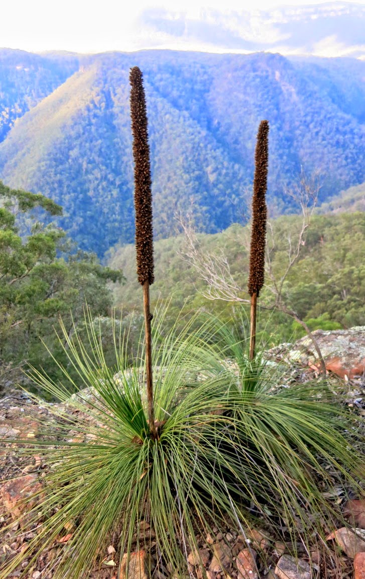
20) Still at the same spot as the previous photo ~~~
Fine specimens of Xanthorrhoea, commonly known as Grasstree or Blackboy.
%2C%2BBlack%2BHorse%2BRidge%2C%2BBlue%2BMts.jpg)
21) We've climbed down the cliff and looking back at it.

22) Continue to descend Black Horse Ridge

23) We are at the end of Black Horse Ridge and are just about to cross this creek - Breakfast Creek. Afterwards ...

24) ... Afterwards, climb up along Carlon Creek towards our cars at Dunphys Camping Area. There is a well formed track along the creek. But it is full of Stinging Nettles and leeches ... not pleasant to walk on.
(The other alternative from Breakfast Creek, is to climb up a ridge on the west side of Carlon Creek. But that ridge is steep!)

Post Script
It is a pleasant outing.
And you really have to admire at the perfect timing by our leader Liam, because by the time we reach our car, it is 7:58pm ... just at the moment of becoming pitch dark as the sun was already set half an hour ago !
3 weeks later, I climb down Carlon Creek and climb up Black Horse Ridge to Mt Warrigal. Photos and write up on the trip are in my blog:
http://mntviews.blogspot.com.au/2015/04/warrigal-nsw-australia.html
This comment has been removed by the author.
ReplyDeleteThanks for posting Paul!
ReplyDeleteAbout to head to Splendour Rock via Blackhorse Ridge and then back via the Ironpots, that gpx file will come in handy!
Robbie
Robbie, thanks for your comment :-)
Delete