2015 October: Day trip to climb Dicky Cooper Bogong and the north peak of The Granite Peaks, NSW Snowy Mts, Australia
Prolog - A2K peaks, the 33 highest peaks in Australia
I have compiled a list of all the peaks in Australia that are 2000 meters or higher. There are 33 of them, all bunched together in Kosciuszko National Park. I am calling the list Paul Ma's A2K peaks :-)
Rank Name Elev Grid Ref
1 Mt Kosciuszko 2228 m 132 647
2 Mt Townsend 2209 m 128 684
3 Mt Twynam 2196 m 179 716
4 Rams Head 2190 m 128 608
5 Etheridge Ridge 2180 m 140 644
6 Rams Head North 2177 m 137 618
7 Alice Rawson Peak 2167 m 132 692
8 Byatts Camp 2159 m 118 676
9 Abbott Peak 2145 m 122 678
10 Carruthers Peak 2145 m 157 698
11 Tenison Woods Knoll 2136 m 166 719
12 Mt Northcote 2131 m 146 676
13 Little Twynam 2130 m 185 711
14 Muellers Peak 2125 m 138 673
15 Mt Clarke 2110 m 154 672
16 Mt Lee 2105 m 152 688
17 Kangaroo Ridge 2077 m 182 644
18 Mt Tate 2068 m 214 760
19 Gungartan 2068 m 258 835
20 Mt Jagungal 2062 m 248 987
21 Mt Perisher 2054 m 243 697
22 Mt Stilwell 2054 m 187 659
23 South Rams Head 2052 m 116 588
24 Kerries Ridge 2050 m 262 851
25 Little Stilwell 2030 m 190 657
26 Merritts Spur 2030 m 160 626
27 Toolong Range 2025 m 258 988
28 Watsons Crags 2021 m 161 733
29 Back Perisher Mtn 2014 m 247 708
30 Mt Anton 2010 m 191 727
31 The Foxhole 2010 m 198 661
32 Mann Bluff 2005 m 208 754
33 Dicky Cooper Bogong 2003 m 232 832
Dicky Cooper Bogong just made it to my A2K list !
How the list is compiled:
- If a peak has a name, and is 2000 meters or higher, then include the peak in the list.
- If a range/ridge/spur has a name, and its highest point is 2000 meters plus, then include the highest point.
For more information on the list, including data source, please click on this link:
http://mntviews.blogspot.com.au/p/paul-mas-a2k-peaks.html
Today's climb: Dicky Cooper Bogong & The Granite Peaks
2 of us for today's climb: RZ and I
Dicky Cooper Bogong: At 2003 meters, is the highest peak in The Rolling Ground ridge in the NSW Snowy Mountains. It gets its name from Dicky Cooper, king of one of the local Aboriginal tribes who had this area as their traditional place for collecting Bogong moths. Hence the mountain came to be known as Dicky Cooper Bogong.
The Granite Peaks: It has 2 peaks.
- North Peak, Sma 0112, 1989 meters
- South Peak, Sma 0691, 1996 meters ... we didn't climb this one today.
In between Dicky Cooper Bogong and the Granite Peaks, and directly west of Whites River Hut, there is an unnamed peak of 1976 meters, We climb it while going from Dicky Cooper Bogong to The Granite Peaks.
Other A2K climbing trips
Scroll forward to the end of this trip report. There is a list, with links, to other A2K climbing trips that I have done.
Maps
1:100,000 8525 Kosciuszko
1:50,000 Kosciuszko Alpine Area map, 1st edition, by Spatial Vision Innovations Pty Ltd
1:25,000 8525-2N Geehi Dam
The relevant part of the 1:50,000 scaled map can be downloaded from:
https://drive.google.com/file/d/0B877-h5SCJaSVTROOTNmZWRhVnM/view?usp=sharing
The relevant part of the 1:25,000 scaled map can be downloaded from:
https://drive.google.com/file/d/0B877-h5SCJaSRWx4QlRrejNzajA/view?usp=sharing
GPS tracklog file & Route
Our GPX tracklog file can be downloaded from:
https://drive.google.com/file/d/0B877-h5SCJaSdXd4MV9vdUdSM0k/view?usp=sharing
The 1,25,000 scaled map with the tracklog superimposed on it can be downloaded from:
https://drive.google.com/file/d/0B877-h5SCJaSQ3AzNW9INXJkNXM/view?usp=sharing
For what it is worth, I have reproduced the map here. Click on the images below to enlarge them. But you are better off to download the map from the above link.
The 3 red arrows, from top to bottom, point to:
- Schlink Hilton Hit
- Whites River Hut
- Demolished Horse Camp Hut


 >
>- Start at Guthega Power Station.
- Initially, walk on Schlink Pass Road.
- Then onto the aqueduct maintenance road west of, and parallel to Schlink Pass Road.
- Visit to Schlink Hilton Hut.
- Climb unnamed peak north of Dicky Cooper Bogong ... the plan is to walk south along the top of The Rolling Ground.
- Climb Dicky Cooper bogong.
- Climb 1976 meter peak south of Dicky Cooper Bogong.
- Climb north peak, Sma 0112, of The Granite Peaks.
- Climb back down to the aqueduct maintenance road which we walked on this morning.
- Return to Guthega Power Station.
Timeline & Distance
07:48 0.0 km Start at Guthega Power Station
08:49 5.0 km At demolished Horse Camp Hut
09:40 8.7 km At junction to Schlink Pass Road
09:45 9.0 km At junction to Whites River Hut
Check whether we like to get out feet wet by crossing a stream to reach Whites River Hut.
No is the answer :-)
09:48 9.2 km Leave junction to Whites River Hut
09:50 9.3 km Stop for morning tea by the side of Schlink Pass Rd overlooking Whites River Hut
Morning tea
10:04 9.3 km Resume walking
10:44 12.2 km At Schlink Hilton Hut
10:58 12.3 km Leave Schlink Hilton Hut
11:04 12.7 km Leave Schlink Pass Road and go off-track towards unnamed peak west of Schlink Hilton Hut
11:32 13.6 km At top of unnamed peak
11:35 13.6 km Leave top of unnamed peak
12:30 15.0 km Stop for lunch at foothill of Dicky Cooper Bogong
Lunch
12:50 15.1 km Start climbing up Dicky Cooper Bogong
13:02 15.2 km At Dicky Cooper Bogong summit
13:19 15.3 km Leave Dicky Cooper Bogong summit
14:04 16.8 km At top of unnamed peak of 1976 meters
14:49 18.5 km At north peak summit, 1989 meters, of The Granite Peaks
15:05 18.6 km Leave north peak summit
16:30 20.5 km At aqueduct maintenance road which we walked on this morning
Rest
16:38 20.5 km Resume walking
18:22 27.4 km Finish at Guthega Power Station
==============================================
Total: 10 hrs 34 mins
27.4 km Distance is from Google Earth
29.7 km Distance is from Garmin GPS
Pictures - Guthega Power Station, start of our walk
1) Guthega Power Station ~~~
We park our car at where I'm standing now - on the near side of the bridge.
The start of the Schlink Pass Road where we'll be walking, is across the bridge and through the gap between the pipes on the left half of the pic and the building on the right half of the pic.

2) On Schlink Pass Road now, and looking back at Guthega Power Station.

To Schlink Hilton Hut
3) Now on the aqueduct maintenance road parallel and to the west of Schlink Pass Road.

There are 3 roads parallel to each other and all heading north from Guthega Power Station.
- On the west side is an aqueduct maintenance road ... the road we are walking on now.
- In the centre is Schink Pass Road.
- On the east side is Disappointment Spur Trail which also serves as an aqueduct maintenance road.
7 months ago, AB, DN, SB and I walked on Schlink Pass Road to climb Kerries Ridge & Gungartan. The return trip was via Disappointment Spur Trail.
Of the 3 roads, Schlink Pass Road is the most scenic because on one side of the road is Munyang River with no trees to block the views. Whereas the other 2 roads have too many trees on the sides of the roads, blocking all views.
Pictures along the Schlink Pass Road are in Photos #3 to # 9 in my blog:
http://mntviews.blogspot.com.au/2015/03/gungartan-kerries-ridge-nsw-australia.html
when I last climbed Kerries Ridge & Gungartan.
4) A manhole to an aqueduct ... there are many of them spaced regularly along the road.

5) We make a short detour to visit Horse Camp Hut, an emergency shelter. But it has been demolished and is being rebuilt. Pictures of the original hut is in my previous climb trip to Kerries Ridge & Gungartan ... see Photo #4 in:
http://mntviews.blogspot.com.au/2015/03/gungartan-kerries-ridge-nsw-australia.html

6) Plenty of this flower by the side of the road ... if you know its name, please let me know.

7) Shortly before the aqueduct maintenance road joins the Schlink Pass Road, it crosses Munyang River here in the form of a dam wall.
- The upper photo is the dam.
- The lower Photo is taken from the dam wall, looking up stream at Munyang River,

8) The aqueduct maintenance road has joined up with Schink Pass Road. Dicky Cooper Bogong is directly in front.

9) We pass by Whites River Hut.
We would have liked to visit the hut and have morning tea there. But in front of it is a stream to cross. As the water level is quite high and we don't want to get our feet wet, so we have morning tea by the side of Schlink Pass Road instead; and just satisfy ourselves with this photo.
In the photo, the grey/white trees are dead snow gums due to a devastating bushfire in 2003.

If you would like to see some photos of the hut and its surrounding areas, please see Photos #9 to #13 in:
http://mntviews.blogspot.com.au/2015/03/gungartan-kerries-ridge-nsw-australia.html
which is an account of my previous climb to Kerries Ridge & Gungartan.
10) We are now half way between Whites River Hut and Schlink Hilton Hut.
The 5 red arrows point to peaks on a ridge called The Rolling Ground. From left to right:
- South peak (Sma 0691) of The Granite Peaks, 1996 meters.
- North peak (Sma 0112) of The Granite Peaks, 1989 meters.
- Unnamed peak of 1976 meters.
- Dicky Cooper Bogong (Sma 0113), 2003 meters.
- Unnamed peak

At Schlink Hilton Hut
11) A stream flowing pass Schlink Hilton Hut ~~~
The peak in the background is an unnamed peak just north of Dicky Cooper Bogong. It is the first peak we will climb after having a rest at the Hut.

12) Schlink Hilton Hut ~~~
It is called Hilton because it is large by the standard of emergency shelters; and all beds have mattresses ... plus cushioned chairs ... what a treat !

13) At Schlink Hilton Hut (the steps of the hut can be seen on the left edge of the photo.) ~~~
This is a good picture of what we intend to do for the rest of the day ... walk along the ridge top called The Rolling Ground, starting from the right.
- First, we are going to climb up the unnamed peak pointed to by the right-most arrow.
- Traverse to the left (south) to climb Dicky Cooper Bogong, 3rd arrow from the left.
- Then climb the unnamed peak of 1976 meters, 2nd arrow from the left.
- And finally, climb the north peak of The Granite Peaks, 1st arrow from the left.

To unnamed peak north of Dicky Cooper Bogong - start of The Rolling Ground
14) (Click on the image to enlarge it.)
We are halfway up the unnamed peak (right most arrow of the previous photo), and looking towards the east (actually, north-east to south-east), across the valley where Munyang River flows.
- The road running across the centre of the pic, from left to right, is Schlink Pass Road.
- The red arrow points to Gungartan. Also see Photo #17 for a closer look at Gungartan.
- The red horizontal bar is Kerries Ridge.
- Below Kerries Ridge, on the Schink Pass Road, you can see Schlink Hilton Hut.
- The range to the right of Gungartan is called Disappointment Ridge/Spur. It would be interesting to walk along the top of that spur one day.

In March this year, 7 months ago, AB, DN, SB and I walked on Schlink Pass Road to Schlink Hilton Hut, then climbed Kerries Ridge and traversed the ridge top all the way to Gungartan. Then we climbed back down to Schlink Pass Road.
Photos and an account of the Kerries Ridge & Gungartan climb is in my blog:
http://mntviews.blogspot.com.au/2015/03/gungartan-kerries-ridge-nsw-australia.html
15) Climbing to the top of the unnamed peak ~~~
- Upper pic: The yellow arrows indicate how we climb to the top.
- Lower pic; The big boulder near the centre of the pic is the highest point.

At top of unnamed peak north of Dicky Cooper Bogong
16) At the top of the unnamed peak which is the start of The Rolling Ground ~~~
The scenery is nice ... towards the north on the far horizon is Mt Jagungal 2061/2062 meters (the elevation is dependent on the map).

17) (Continuation to the right of previous pic ... Click on the image to enlarge it.)
Another look towards east (actually, north-east to south-east), across the valley where Munyang River flows.
- The road running across the centre of the upper pic, from left to right, is Schlink Pass Road.
- The red arrows in both pics point to Gungartan summit.
- The red horizontal bar is Kerries Ridge.
- The view to Schlink Hilton Hut is blocked by the rock pointed to by the yellow arrow.
- The range to the right of Gungartan is called Disappointment Ridge/Spur.
- The lower pic is zooming into the green box of the upper pic.

18) (Continuation to the right of previous pic)
Still at the top of the unnamed peak ... towards the south is Dicky Cooper Bogong

To Dicky Cooper Bogong
19) We've descended the unnamed peak ... looking back at it.

20) We now walk south along the top of the ridge, called The Rolling Ground, towards Dicky Cooper Bogong. Along the way, there are many rocky hills. The 2 pics here are the top of the first rocky hill that we climb through.
Upper pic - Climbing up to the top of these rocks.
Lower pic - Climbed down from the the rocks and looking back at it.

21) From the top the rocks (previus pic) is this view of Dicky Cooper Bogong.
We now head towards the rocky hill to the left of Dicky Cooper Bogong.

22) We are almost at the top of the rocky hill mentioned in the previous photo. It has a series of piles of granite rocks; and we are climbing through them all.

23) RZ at the top the pile of rocks of the previous photo.

24) Another pile of granite rocks a short distance away ~~~
We'll climb it too.

25) Climbing up the pile of rocks in the previous photo ~~~
This is the highest point of this rocky hill.

26) From the top of the rocks in the previous photo, towards north and east ~~~
(Click on the image to enlarge it.)
Left to right:
- 1st arrow: Mt Jagungal, directly north
- 2nd arrow: Schlink Hilton Hut by the side Schlink Pass Road
- Horizontal bar: Kerries Ridge
- Last arrow: Gungartan, directly east

27) Still at the top of the rocks, and towards south and south-west:
One more pile of granite rocks to climb through, then it will be Dicky Cooper Bogong (towards south-west).

28) Closer to Dicky Cooper Bogong ~~~
In the lower pic, the yellow arrows point to where we will climb up to its summit.
The yellow rectangle box marks a tree under which we'll to have our lunch.

29) We have lunch under this tree at the base of Dicky Cooper Bogong.
The rocky hill on the left side of the pic is the pile of rocks in photo #27.

Climb Dicky Cooper Bogong
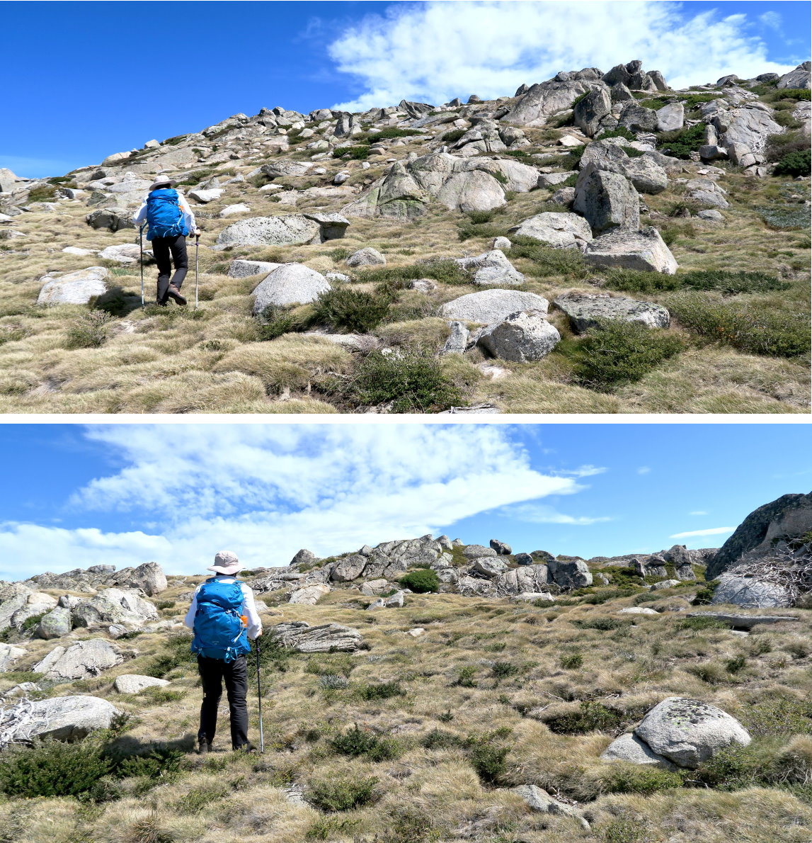
30) After lunch, we climb up the slope of Dicky Cooper Bogong. This slope is between the two yellow arrows in Photo #28.

Dicky Cooper Bogong summit
31) RZ at the summit of Dicky Cooper Bogong

32) Dicky Cooper Bogong summit from another angle

33) I'm at the summit of Dicky Cooper Bogong

34) Plenty of boulders around the summit ~~~
In the lower pic, the 3 large boulders are the 3 boulders in the upper pic to the left of RZ.

35) RZ climbs up one of the boulders.

36) From the top, towards north and east (Click on the image to enlarge it.) ~~~
Left to right:
- 1st arrow: Mt Jagungal, directly north
- 2nd arrow: Schlink Hilton Hut by the side Schlink Pass Road
- Horizontal bar: Kerries Ridge
- Last arrow: Gungartan, directly east

37) Still at the summit of Dicky Cooper Bogong ~~~
Toward the south-west is the Main Range and Abbot Range.
The 5 red arrow point to, from left to right:
- Mt Tate
- Little Twynam
- Mt Twynam
- Tenison Woods Knoll (West of Mt Twynam, half way between Mt Twynam and Mt Sentinel)
- Mt Townsend

To unnamed peak, 1976 meters, south of Dicky Cooper Bogong
38) Can't stay at the summit of Dicky Cooper Bogong for ever :-) ~~~
We've climbed down from it and looking back at it.

39) We are on our way to an unnamed peak, 1976 meters, midway between Dicky Cooper Bongong and The Granite Peaks. ~~~
Passing some interesting rock formations

40) Whenever there is a pile of rocks, RZ will climb to the top ... she leaves no rock unclimbed, and is like a toddler finds a jar of candies :-)

41) Looking back at Dicky Cooper Bogong

42) Another pile of granite rocks on the way to the unnamed peak

43) Walking towards unnamed peak of 1976 meters

44) Climbing up to the top of unnamed peak of 1976 meters

At top of unnamed peak, 1976 meters, south of Dicky Cooper Bogong
45) We've just climbed up to the plateau of the 1976-meter unnamed peak.
Looking back towards the north at Dicky Cooper Bogong

46) From the top of the unnamed peak (or very close to it), looking towards the south (which is where we are heading) ~~~
- The left red arrow points our next destination - it is the start of the ridge where The Granite Peaks are.
- The right arrow points to North peak (Sma 0112) of The Granite Peaks, 1989 meters.

To north peak of The Granite Peaks
47) We've climbed down from the unnamed peak and now looking back at it.

48) Walking towards The Granite Peaks ~~~
This pic is similar to Photo #46.
- The left red arrow points our next destination - it is the start of the ridge where The Granite Peaks are.
- The right arrow points to north peak (Sma 0112) of The Granite Peaks, 1989 meters.
- The pile of rocks in the red circle is in Photo #49.

49) This is the pile of rocks mentioned in the previous photo.
And no ... this time, we didn't climb it. We are getting a bit tired with all the climbing, and there is still a lot of ground to cover.

50) Instead, we climb to the top of this pile of rocks which is the highest point of the start of the ridge to The Granite Peaks. It is the same pile of rocks pointed to by the left red arrow in photo #48.

51) Very near the top now

52) We'v climbed down from the top of the previous photo and are now heading to the North peak of The Granite Peaks.

53) Climbing to the summit of the North peak of The Granite Peaks
At summit of north peak of The Granite Peaks
54) RZ and I at the summit of the north peak, 1989 meters, (Sma 0112) of The Granite Peaks ~~~
The red arrows point to the South peak, 1996 m, (Sma 0691) of The Granite Peaks.

55) (Continuation to the right of the previous pic)
Towards the south-west is the Main Range and Abbott Range.
The 6 red arrows point to, from left to right:
- Mt Tate
- Little Twynam
- Mt Twynam
- Tenison Woods Knoll (West of Mt Twynam, half way between Mt Twynam and Mt Sentinel)
- Mt Townsend
- Alice Rawson Peak

56) Still at the summit of the north peak of The Granite Peaks ~~~
This view is toward the north-west and east.
The 4 red arrow point to, from left to right:
- Unnamed 1976 meter peak that we climbed earlier on
- Dicky Cooper Bogong, directly north
- Mt Jagungal
- Gungartan, north-east
The horizontal bar is Kerries Ridge
The green boxes are magnified in the lower pics.

Climb down The Rolling Ground and return to car
We are meant to keep going to the south peak of The Granite Peaks. But RZ's foot is hurting from all the rock climbing she has been doing. So we call it a day, turn east and more or less make a beeline for the road that we walked on this morning. Just as well, I am a bit tired too and happy to go home earlier.
57) In this pic, we've climbed down from the north peak and looking at the south peak (red arrow) of The Granite Peaks.

58) Crossing the snow field of the previous pic

59) Looking back at where we came from ~~~
The red arrow points to the north peak of The Granite Peaks.

60) This is where we are heading ... directly east - centre of the horizon.

61) Crossing another snow field

62) This is the snow field we've just crossed.

63) (Click on the image to enlarge it.)
We are walking straight ahead. It will soon be steep downhill !
The valley across the centre of the pic is where Munyang River flows.
- The left red arrow points to Kerries Ridge.
- The right arrow points to Gungartan.
- The range to the right of Gungartan and overlooking the valley is Disappointment Ridge.
- There are 2 roads running horizontally across the centre of pic. The lower road is called Schlink Pass Road. The upper road is Disappointment Spur Trail.

7 months ago, AB, DN, SB and I walked on Schlink Pass Road to climb Kerries Ridge & Gungartan. The return trip was via Disappointment Spur Trail.
So far, the walk from the north peak of The Granite Peaks to here is easy going. But now we climb down a steep slope towards the aqueduct maintenance road we walked on this morning, and it is difficult !
64) It is incredibly thick scrub here, one of the most impenetrable thicket I've ever scrub-bashed !
The ground is also criss-crossed by numerous small streams fed by meltwater from the snow fields further up the slope, making progress extremely difficult.

65) Finally, we are down to the aqueduct maintenance road. I need a rest from the heavy duty scrub-bashing.

66) Near where I have a rest (previous pic), is an aqueduct opening. In fact there are plenty of them along the road. They are also in the Disappointment Spur Trail ... see Photo #54 in:
http://mntviews.blogspot.com.au/2015/03/gungartan-kerries-ridge-nsw-australia.html
It is used to capture water running down little streams from the slopes above and feed the water via underground channels to Guthega Power Station.

After the rest, it is retracing the aqueduct maintenance road back to our car at Guthega Power Station.
67) RZ found a feather ... must be quite a large bird. Wonder what bird is it?
(PS. Ken advises it is from a Lyrebird.)

All up, it is a pleasant day roaming along the top of The Rolling Ground ... and thanks to RZ for your company.
Other A2K climbing trips
• 2017 November
Rank Name Elev Grid Ref
20 Mt Jagungal 2062 m 248 987
27 Toolong Range 2025 m 258 988
Trip report will be written up soon ... whatever that means :-)
In the mean time, if you like to know the details, contact me.
• 2017 January with AB
Rank Name Elev Grid Ref
18 Mt Tate 2068 m 214 760
32 Mann Bluff 2005 m 208 754
Photos and trip report are in my blog:
http://mntviews.blogspot.com.au/2017/01/mt-tate-mann-bluff-gills-knobs.html
• 2016 December with AB
Rank Name Elev Grid Ref
3 Mt Twynam 2196 m 179 716
11 Tenison Woods Knoll 2136 m 166 719
28 Watsons Crags 2021 m 161 733
30 Mt Anton 2010 m 191 727
Photos and trip report are in my blog:
http://mntviews.blogspot.com.au/2016/12/tenison-woods-knoll-watsons-crags.html
• 2016 December with AB & DN
Rank Name Elev Grid Ref Comment
17 Kangaroo Ridge 2077 m 182 644 Morning
21 Mt Perisher 2054 m 243 697 Afternoon
22 Mt Stilwell 2054 m 187 659 Morning
25 Little Stilwell 2030 m 190 657 Morning
28 Back Perisher Mtn 2014 m 247 708 Afternoon
31 The Foxhole 2010 m 198 661 Morning
Photos and trip reports are in my blog:
- Morning: http://mntviews.blogspot.com.au/2016/12/mt-stilwell-and-kangaroo-ridge.html
- Afternoon: http://mntviews.blogspot.com.au/2016/12/mt-perisher-back-perisher-mtn.html
• 2015 October with RZ
Rank Name Elev Grid Ref
33 Dicky Cooper Bogong 2003 m 232 832
This trip report :-)
• 2015 March with AB, DN & Saf
Rank Name Elev Grid Ref
19 Gungartan 2068 m 258 835
24 Kerries Ridge 2050 m 262 851
Photos and trip report are in my blog:
http://mntviews.blogspot.com.au/2015/03/gungartan-kerries-ridge-nsw-australia.html
• 2014 December with AB & DN
Rank Name Elev Grid Ref Comment
1 Mt Kosciuszko 2228 m 132 647
2 Mt Townsend 2209 m 128 684 Abbott Range
7 Alice Rawson Peak 2167 m 132 692 Abbott Range
8 Byatts Camp 2159 m 118 676 Abbott Range
9 Abbott Peak 2145 m 122 678 Abbott Range
10 Carruthers Peak 2145 m 157 698
12 Mt Northcote 2131 m 146 676
wrong Byatts Camp 2110 m 116 671 Abbott Range
15 Mt Clarke 2110 m 154 672
16 Mt Lee 2105 m 152 688
Photos and trip report are in my blog:
http://mntviews.blogspot.com.au/2014/12/lee-northcote-clarke-abbott-range.html
• 2014 November with AB & DN
Rank Name Elev Grid Ref
1 Mt Kosciuszko 2228 m 132 647
4 Rams Head 2193 m 128 608
5 Etheridge Ridge 2180 m 140 644
6 Rams Head North 2177 m 137 618
23 South Rams Head 2052 m 116 588
Photos and trip report are in my blog:
http://mntviews.blogspot.com.au/2014/11/etheridge-ridge-kosciuszko-rams-head.html
• 2014 April with DH
Rank Name Elev Grid Ref
1 Mt Kosciuszko 2228 m 132 647
2 Mt Townsend 2209 m 128 684
3 Mt Twynam 2196 m 179 716
10 Carruthers Peak 2145 m 157 698
13 Little Twynam 2130 m 185 711
and incidentally bagging the 3 highest peaks of Australia in one day. Photos and trip report are in my blog:
http://mntviews.blogspot.com.au/2014/04/kosciuszko-townsend-twynam-carruthers.html
• 2011 April with RE
Rank Name Elev Grid Ref
1 Mt Kosciuszko 2228 m 132 647
2 Mt Townsend 2209 m 128 684
14 Muellers Peak 2125 m 138 673
Photos and trip report are in my blog:
http://mntviews.blogspot.com.au/2011/04/kosciuszo-muellers-peak-townsend-nsw.html
Dead trees are due to fire damage. Snow gums regrow slowly or not at all after fire, so there are huge numbers of dead ones from the 2002 fires.
ReplyDeleteFeather is a lyrebirds.
Hi Ken, Thanks on the Lyrebird info.
DeleteOn dead trees: From an earlier trip to this area, a notice at the door of White River Hut says they are due to Phytophthora.
There is Phytophora and it will kill trees but that hasn't what has happened here. The signs are warning to avoid adding Phytophora to the problems they are having. Photo 18 shows typical fire damage for snow gums, with the trees reshooting from the root mass, which is the only thing that survives the fires. Phytophora kills the roots first.
DeleteHi Ken, Thanks. I've updated the blog to say that the dead trees are due to the fire.
Delete