2020 April: Day-trip
Sea Cliff Bridge to Coalcliff Dam via Stanwell Creek
Illawarra Escarpment SCA, NSW, Australia
Preview - Sea Cliff Bridge, Stanwell Creek, Coalcliff Dam
A quick preview of the photographs are in this link:
https://drive.google.com/file/d/1QemRvNsXVXUln6fMwDx1HQ2ZEYLv82jK/view?usp=sharing
Below are 3 representatives :
Sea Cliff Bridge

Stanwell Creek

Coalcliff Dam

Interested ?
Then read on :-)
Our group
4 of us: Yus, Stanley, Lee and I
Map
Map 1) LPI 1:25,000 scaled 9029-1S Appin

GPS tracklog file & route
The GPX tracklog file of our walk can be downloaded from:
https://drive.google.com/file/d/1I-C8el0d2iH0UvoY_XVTlPnkCrdzbi_Q/view?usp=sharing
Map 2) The same GPS tracklog superimposed in the following 1:25,000 topographic map ~~~
- Route is in red, figure 8 circuit. Upper (smaller) circuit is counter-clockwise. Lower (larger) circuit is clockwise.
- 4 blue arrows, clockwise from top-left:
1 GR 127 103 - Unnamed waterfall ... photos #62, #63, #64
2 GR 132 105 - Delightful water pool on Stanwell Creek ... photos #48, #49, #50 (almost at GR 131 105)
3 GR 135 088 - Carpark and start of the walk
4 GR 133 075 - Access hole to climb to top of Illawarra Escarpment ... photos #13, #14, #15
- Pink arrow (east of Coalcliff Dam): It maybe possible to climb up the cliff along this arrow.
- 7 brown arrows, clockwise from bottom:
Lookout 1, GR 124 083 ... Not a good lookout, too many trees :-(
Lookout 2, GR 127 090
Lookout 3, GR 130 092, almost at 129 092
Lookout 4, GR 136 095
Lookout 5, GR 136 098, almost at 137 098
Lookout 6, GR 135 098, almost at 136 098
Lookout 7, GR 140 098 ... Near right edge of image below

Map 3) Satellite image of previous map ~~~
- Route is in red, figure 8 circuit. Upper (smaller) circuit is counter-clockwise. Lower (larger) circuit is clockwise.

In summary, the route for today is:
- Start at a carpark, GR 135 088, midway along Bombora Way, Coalcliff.
- Walk on Paterson Road.
- Onto Lawrence Hargrave Drive.
- Walk under Sea Cliff Bridge.
- Climb back up to Lawrence Hargrave Dr.
- Through access hole to Forest Walking Track ("Forest Path" in OpenStreetMap).
- Walk on Forest Walking Track along top of Illawarra Escarpment.
- Visit various lookouts along Forest Walking Track.
- Onto Wodi Wodi Walking Track.
- Walk upstream of Stanwell Creek.
- Then along southern tributary of Stanwell Creek.
- Climb up cliffs to Coalcliff Dam.
- Return to carpark via Wodi Wodi Walking Track, Lawrence Hargrave Drive, Bombora Way.
Timeline & Distance
Park cars at a carpark, Grid Ref 135 088, midway along Bombora Way, Coalcliff.
It is an access road to Coalcliff Beach.
But note: The access road is not named in Google Maps.
07:32 0.0 km Start walking
07:41 0.7 km Climb down Lawrence Hargrave Drive, so as to walk under Sea Cliff Bridge
08:01 1.65km Near where we are to climb up a ladder to Lawrence Hargrave Dr at southern end of the bridge
Explore around
08:10 1.8 km Start climbing up ladder to Lawrence Hargrave Dr
08:15 1.96km At Lawrence Hargrave Dr
08:16 2.02km At access hole to climb to lookouts over Sea Cliff Bridge
08:24 2.2 km At lookouts to Sea Cliff Bridge (There are a few lookouts around the same area.)
08:31 2.25km Leave lookouts
08:58 2.6 km Stop for morning tea
Morning tea
09:11 2.65km Resume walking
09:44 3.25km At Forest Walking Track ("Forest Path" in OpenStreetMap)
09:46 3.35km Lee sprains her ankle
10:02 3.4 km Resume walking
10:15 4.05km At lookout 1 (Can't see much, too many trees around.)
10:16 4.05km Leave lookout 1
10:48 5.55km At lookout 2, towards Coalcliff & Coalcliff colliery (Illawarra Coke Works)
10:58 5.55km Leave lookout 2
11:15 6.35km At lookout 3, towards Coalcliff & Coalcliff colliery (Illawarra Coke Works)
11:21 6.35km Leave lookout 3
11:34 7.2 km At lookout 4, towards Coalcliff
11:37 7.2 km Leave lookout 4
11:41 7.5 km At lookout 5, towards Stanwell Park
11:42 7.5 km Leave lookout 5
11:45 7.6 km At lookout 6, towards Stanwell Park
The lookout has an interesting rock with a hole ... photos #42 and #43
11:49 7.6 km Leave lookout 6
11:54 7.85km At junction of Forest Walking Track & foot track to Coalcliff Dam
12:03 8.25km At junction of Forest Walking Track & Wodi Wodi Walking Track
12:26 9.1 km At a delightful water pool at junction of Wodi Wodi Walking Track and Stanwell Creek
Lunch
12:54 9.2 km Start walking upstream (west) of Stanwell Creek
13:03 9.4 km At confluence of Stanwell Creek and its southern tributary
13:58 9.85km At an unnamed waterfall on the southern tributary of Stanwell Creek
14:07 9.9 km Resume walking
14:28 10.05km At base of cliffs ... Can't climb up further, turn left (east) to walk along the base of the cliffs.
14:39 10.15km At where we can climb up the cliffs
14:41 10.15km Start to climb up
14:51 10.25km At foot track to Coalcliff Dam
14:54 10.48km At spillway of Coalcliff Dam (ie eastern tip of the dam)
Explore around spillway
15:03 10.73km Leave Coalcliff Dam
15:08 11.0 km Same spot as at 14:51 ... Now we keep going along the foot track
15:22 11.75km At junction of foot track & Forest Walking Track ... same spot as at 11:54
15:33 12.15km At junction of Forest Walking Track and Wodi Wodi Walking Track ... same spot as at 12:03
15:50 13.05km At lookout 7 towards Illawarra railway line
15:51 13.05km Leave lookout 7
16:03 13.4 km At Lawrence Hargrave Dr
16.25 14.8 km Back at carpark
==============================================
Total: 8 hrs 53 mins
14.8 km Distance is from Google Earth
Pictures - Carpark
Grid Ref: 135 088
Park Stanley and my cars at a carpark midway along Bombora Way, Coalcliff.
It is an access road to Coalcliff Beach.
By the way, the access road is not named in Google Maps !!!
1) My car is on the right. I arrived with Yus.
Stanley and Lee will arrive half an hour later. Lee slept in :-)
No harm done :-) We'll complete the walk with plenty of daylight left :-)

Tree of thongs
2) Walking to Sea Cliff Bridge ~~~
- In case you are interested to see this tree, address is :
283 Lawrence Hargrave Drive (intersection with Paterson Rd), Coalcliff
- Lower pics: Google street view captured in Dec 2013, more than 6 years ago.
At the time, there were already thongs and shoes on the tree (red circle).

Sea Cliff Bridge
3) Sea Cliff Bridge links the coastal towns of Coalcliff and Clifton.
It carries two lanes of traffic each way, a separated cycleway and pedestrian walkway.
- Yellow arrows: Our route ... we'll walk under the bridge.

4) I am standing near the middle yellow arrow of photo #3, looking back at Lee (left) and Stanley (right).
(To enlarge the image, click on it.)
- Yellow arrows: Our route ... Right-most arrow is along Lawrence Hargrave Dr.

5) Beach scene ~~~
- White ovals in the pics below: They circle the same area.

6) Sea Cliff Bridge ~~~
- Yellow rectangle/arrow: We'll use a ladder there to climb up to the road ... Refer to photos #10 and #11.

7) Looking back at Sea Cliff Bridge

8) Looking back at Sea Cliff Bridge ~~~
- We have been walking under the bridge.
- White arrow on left edge pointing at a very small figure: Stanley

9) Yus ~~~
- We are near the ladder ... Refer to next pic.

Ladder up the cliff
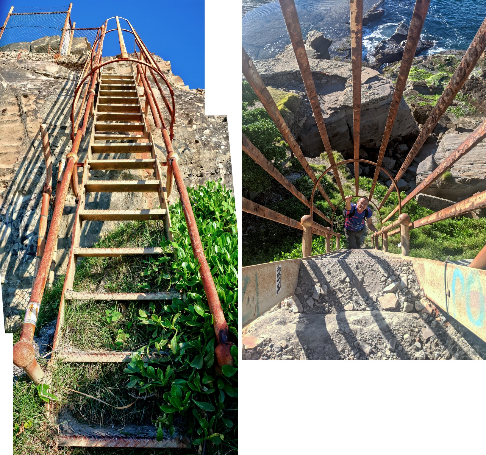
10) Now climbing up the ladder ... aiming for Lawrence Hargrave Dr at southern end of Sea Cliff Bridge ~~~
- Yus is inside the ladder.
- White circle: What we saw in photo #6 (yellow rectangle there)
- Yellow arrow: After climbing up the ladder, go over to the left to climb up the stairs to Lawrence Hargrave Dr.
- Red oval: Sea Cliff Bridge

11) The ladder ~~~
- Right pic: Stanley (Photographer: Lee)
12) 200-degree panorama ... photo taken between the ladder and the stairs to Lawrence Hargrave Dr ~~~
- Upper pic:
• White oval: Sea Cliff Bridge ... Earlier on, we walked under the bridge.
• White arrow: The ladder of previous pics is there.
• Yellow arrow: Our route
- Lower pic: (Continuation from the right of the upper pic)
• Yellow arrow: Our route ... leading to the stairs to Lawrence Hargrave Dr
• Red arrow: Yus

Access hole (to top of Illawarra Escarpment)
13) We've climbed up the stairs, now at Lawrence Hargrave Dr at the southern end of Sea Cliff Bridge.
- Upper pic:
• 2 ovals: Access hole (yellow oval) to climb to top of Illawarra Escarpment (red oval, top-right corner)
• Lee (left) & Stanley (right) are to the left of the hole (yellow oval).
- Lower pic: (Continuation from the right of the upper pic)
• Red solid arrow: Sea Cliff Bridge

14) Access hole (GR 133 075) to climb to top of Illawarra Escarpment ~~~
- Upper pic:
• Yus facing the hole
• Yellow arrows: Direction of walk
• Lawrence Hargrave Dr is on the right.
- Lower pic: Yus posing inside the hole

15) Inside the access hole ~~~
- Upper pic: There is a well-defined foot track (yellow arrow) ...
- Lower pic: ... even a rope (yellow oval) to help you to climb up.

Lookout to Sea Cliff Bridge
16) About 200 meters after entering the hole, we come to a few lookouts. All the lookouts are close to each other and are towards Sea Cliff Bridge.
- Yellow arrows in both pics below: Earlier on, our route was under the bridge.
- Lower pic: Continuation from the right of the upper pic

17) Lee

Bushbash to the ridge of Illawarra Escarpment
18) Bushbashing to the ridge of Illawarra Escarpment ~~~
- Lower pic: Lee

19) Lantana camara (Common Lantana) in full bloom (Photographer: Lee)

20) Gomphocarpus physocarpus (or G. fruticosus) ~~~
It is native to south-east Africa, but it has been widely naturalized everywhere. (Photographer: Lee)

21) Some climbing to do :-) ... The 3 pics below are of the same scene.

Forest Walking Track
Eventually, we are at Forest Walking Track which goes along the top of the ridge of Illawarra Escarpment.
This foot track has many names:
- LPI map : Forest Walking Track
- OpenStreetMap: Forest Path
- Google Earth : Illawarra Escarpment Track
- Google Map : Forest Walking Track
22) Somewhere along the foot track, Lee tripped and sprained her foot.
Not serious ... Yus is taping up her foot.
Lower pic: Nevermind the sprain ... I am more interested in her colourful shoes ! :-)

However, in photo #61, Lee slips and fractures her sprained foot ... For more on this, refer to the commentary there.
23) Forest Walking Track ~~~
- Left to right: Stanley, Lee, Yus ... Lee is up and walking again.

Stony Creek and its tributary
24) Lee and foot bridge over Stony Creek

25) Crossing an unnamed tributary on the north side of Stony Creek ~~~
- Upper pic, left to right: Lee, Stanley
- Middle pic: Downstream
- Lower pic: Upstream

Lookout 1 towards Coalcliff
Grid Ref: 124 083
For the purpose of this trip report, I've labelled this lookout as lookout 1.
Not a good lookout ... too many trees :-(
Lookout 2 towards Coalcliff
Grid Ref: 127 090
For the purpose of this trip report, I've labelled this lookout as lookout 2.
The lookout is a rocky platform with a view towards Coalcliff and Coalcliff colliery (Illawarra Coke Works).
26) Approaching lookout 2, a rocky platform ~~~
- Upper pic: Stanley
• White oval: A dumped car, quite an eyesore
Why didn't the management of NSW State Forests remove it in all these years ?

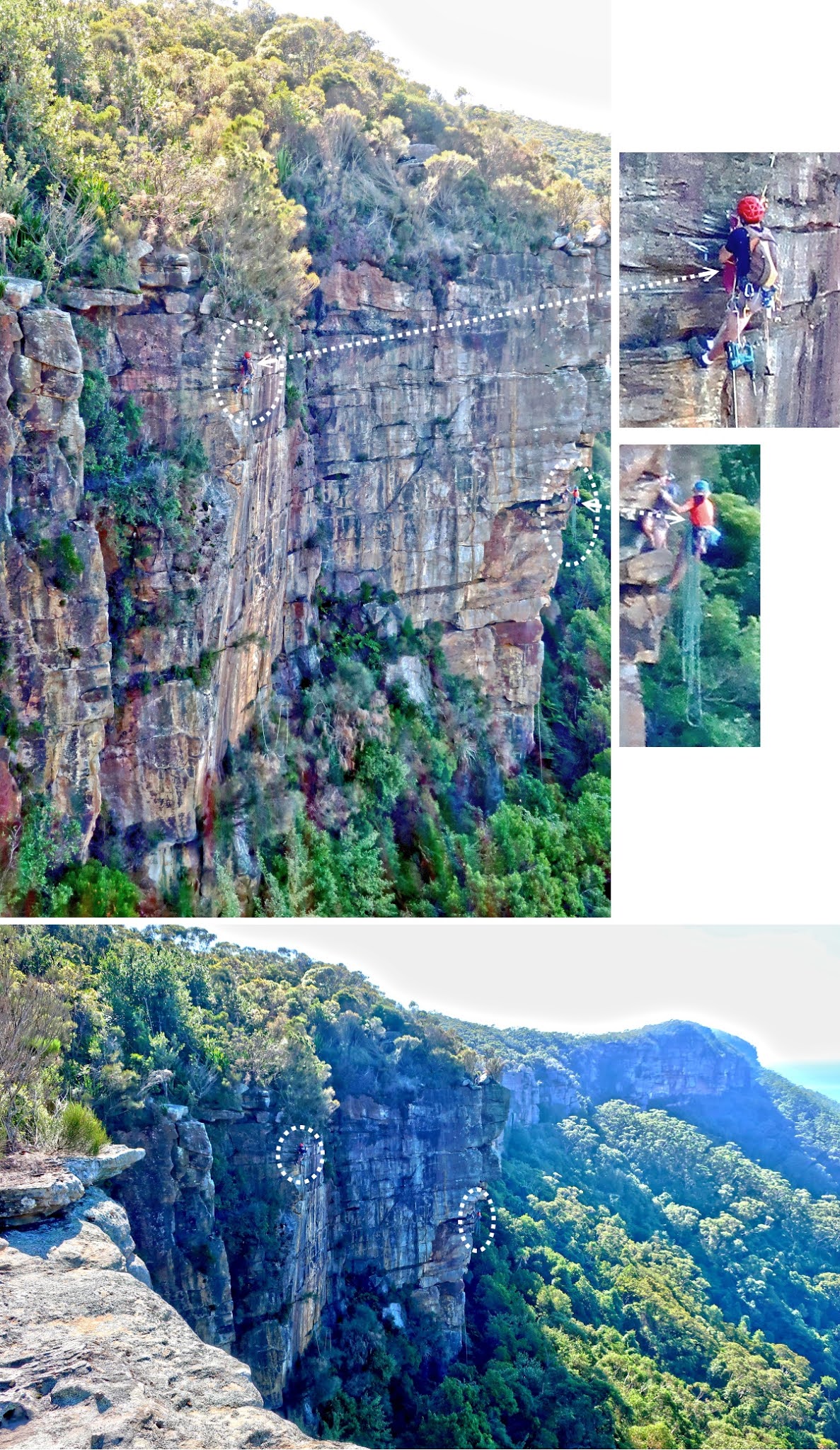
27) Rock climbers on sheer cliffs ~~~
- Lower pic:
• Lower left corner: I'm standing at the edge of the rocky platform there.
• Continuation to the right of this pic is photo #28.
28) 180-degree panorama towards Coalcliff ~~~
- Upper pic: (Continuation from the right of previous pic)
• At the centre is the town of Coalcliff and Coalcliff colliery (Illawarra Coke Works).
• Photo #29 zooms into this area.
• Black arrow: Where our cars are parked ... See also photo #29.
- Lower pic: (Continuation from the right of the upper pic)
• Cyan oval: The rock platform where I'm now standing.
• Continuation to the bottom of the right half of this pic is photo #30.

29) Zooming into the town of Coalcliff and Coalcliff colliery (Illawarra Coke Works) ~~~
- Upper pic: Coalcliff and Coalcliff colliery
• Black arrow: Where our cars are parked, at Grid Ref 135 088, midway along Bombora Way, Coalcliff.
• Yellow arrows: Our route from carpark towards Sea Cliff Bridge
- Lower pic: Lee (Photographer: Yus)

30) (Continuation from the bottom on the right half of photo #28)
At the bottom of the cliffs are car wrecks. Photo #31 zooms into this area.

31) Zooming into the car wrecks at the bottom of previous pic

Lookout 3 towards Coalcliff
Grid Ref: 130 092 (almost at 129 092)
Similar to Lookout 2, this lookout is also towards Coalcliff and Coalcliff colliery (Illawarra Coke Works).
32) Almost 180-degree panorama ~~~
- Upper pic: Towards the town of Coalcliff ... Photo #33 zooms into the town.
• Yellow dot: Where our cars are parked, at Grid Ref 135 088, midway along Bombora Way, Coalcliff.
• Bottom-right of the pic: Coalcliff colliery (Illawarra Coke Works)
- Lower pic: (Continuation from the right of the upper pic)
• Yellow circle: Lookout 2 ... Photo #34 zooms into there. Also refer to photos #27 to #30.
• Left part of the pic: Coalcliff colliery (Illawarra Coke Works) ... Photo #35 zooms into this area.

33) Coalcliff, the town in photo #32 ~~~
- Yellow dot: Where our cars are parked, at Grid Ref 135 088, midway along Bombora Way, Coalcliff.
- Yellow arrows: Our route from carpark towards Sea Cliff Bridge
- Red dot: Tree of thongs in photo #2, 283 Lawrence Hargrave Dr (intersection with Paterson Rd)

34) Towards lookout 2, yellow circle in photo #32's lower pic ~~~
- We can see the sightseers and rock climbers.

35) Coalcliff colliery (Illawarra Coke Works) ~~~
- Lower pic: Stanley having fun ... pretending to be climbing up from below :-)

Lookout 4 towards Coalcliff
Grid Ref: 136 095
36) From lookout 4, we can see Sea Cliff Bridge and the town of Coalcliff.
- Red arrow: Sea Cliff Bridge
- Yellow Dot: Where our cars are parked, at Grid Ref 135 088, midway along Bombora Way, Coalcliff.
- Road along bottom of the pic: Lawrence Hargrave Dr on the north side Coalcliff.

37) Same view as above pic ~~~
- Yellow Dot: Where our cars are parked, at Grid Ref 135 088, midway along Bombora Way, Coalcliff.
- 2 red arrows, top to bottom:
1 Sea Cliff Bridge
2 Tree of thongs in photo #2, 283 Lawrence Hargrave Dr (intersection with Paterson Rd)
- Yellow & blue arrows: Our route from carpark to Sea Cliff Bridge
Blue arrow is along Lawrence Hargrave Dr on the south side Coalcliff.
- We walked under Sea Cliff Bridge ... photos #4 to #8.

Lookout 5 towards Stanwell Park
Grid Ref: 136 098 (almost at 137 098)
38) Stanley approaching lookout 5 towards Stanwell Park

39) At lookout 5

40) 120-degree panorama from lookout 5 ~~~
- Upper pic: Smoky. Fuel-reduction burning ??? But we had a humongous bushfire only 2 months ago ... strange !
- Lower pic: (Continuation from the right of the upper pic)
• Towards Stanwell Park ... Photo #41 zooms into this area.

41) Zooming into Stanwell Park of the previous pic ~~~
- Upper cyan dots: Hargraves Creek
- Lower cyan dots: Stanwell Creek

Lookout 6 towards Stanwell Park
Grid Ref: 135 098 (almost at 136 098)
42) What makes this lookout interesting is this rock with a hole.
- Lower pic: Lee having fun

43) Stanley having fun with my head (Photographer: Yus) ~~~
- I poke my head from underneath the hole, whereas in the previous pic, Lee looked down from above the hole.

44) View from top of the rock ~~~
- Upper pic: This view towards Stanwell Park is similar to photo #41.
• Upper cyan dots: Hargraves Creek
• Lower cyan dots: Stanwell Creek
- Lower pic: Forest Walking Track ("Forest Path" in OpenStreetMap; "Illawarra Escarpment Track" in Google Earth)
• Yellow arrow: We are heading in that direction now.
• Lee's blue backpack is on the ground.

Forest Walking Track to Wodi Wodi Walking Track
45) On Forest Walking Track, heading towards Wodi Wodi Walking Track ~~~
- Left pic: Yus is in front.

Wodi Wodi Walking Track
46) Now on Wodi Wodi Walking Track ~~~
- Upper pic: 3 small figures left to right: Lee, Stanley, Yus

47) Wodi Wodi Walking track is about to cross Stanwell Creek.
(We won't cross the creek. We'll have lunch around here, then turn left, upstream.)
- Left to right: Yus, Lee ... The others do not belong to our group.

Water pool on Stanwell Creek
48) From where the previous pic was taken, turn right (east, downstream) for a few steps and you'll come to this delightful water pool.
- 2 people from left to right:
• Guy swimming: Not our group
• Stanley

49) Same pool as previous pic ... Photo taken near where Stanley was in previous pic ~~~
- Left to right: Yus, Lee, Stanley ... We are having lunch here.
- My cyan-coloured backpack is to the left of Yus.

50) Same pool (To enlarge the image, click on it.)

Stanwell Creek
51) After lunch, it is walking upstream of Stanwell Creek.
- Upper pic:
• Left to right: Lee, Stanley, Yus
• Picture taken close to Wodi Wodi Walking Track
• And is the same scene as photo #16 in my trip report on Stanwell Creek to Kellys Falls :
http://mntviews.blogspot.com/2020/05/stanwell-creek-to-kellys-falls.html
(You should be able to identify the same rocks in both pics.)
- Lower pic: Further upstream
• Left to right: Yus, Lee

Junction of Stanwell Creek & its southern tributary
52) We arrive at the junction of Stanwell Creek and its southern tributary.
- Upper pic:
• The 2 cairns here are the same as ones in photo #18 in my trip report on Stanwell Creek to Kellys Falls :
http://mntviews.blogspot.com/2020/05/stanwell-creek-to-kellys-falls.html
• Alan Chan said the cairns are new. He didn't notice them when he came through here few months ago.
- Lower pic: (Continuation from the right of the upper pic)
• Left to right: Yus, Lee
• Yellow arrow: Next, we'll walk upstream of the southern tributary of Stanwell Creek.

53) Stanwell Creek - upstream ~~~
We won't go there today.
We'll go there 3 weeks later; refer to my trip report on Stanwell Creek to Kellys Falls :
http://mntviews.blogspot.com/2020/05/stanwell-creek-to-kellys-falls.html

54) Another view of Stanwell Creek - upstream ~~~
We won't go there today.
We'll go there 3 weeks later; refer in my trip report on Stanwell Creek to Kellys Falls :
http://mntviews.blogspot.com/2020/05/stanwell-creek-to-kellys-falls.html
- Lower pic: (Continuation from the right of the upper pic)
• This scene is similar to photo #53.

Southern tributary of Stanwell Creek
55) We've left the junction, now walking upstream along the southern tributary of Stanwell Creek.
(To enlarge the image, click on it.)
- Left to right: Stanley, Lee
- Photo #56 zooms into the left and right halves of this pic.

56) Zooming into the left and right halves of above pic.
- Upper pic: Stanley
- Lower pic, left to right: Stanley, Lee

57) Small waterfalls along the creek ... The 2 pics below are different waterfalls.

58) Scene along the creek ~~~
- Upper pic: Looking back
• Yellow arrow: Direction of walk
- Lower pic: Lee climbing

59) Vines

60) Need to climb up this rock ... Use the vine ... Refer to photo #61.
- Left to right: Stanley, Yus

61) The 3 pics here are taken at where Stanley was in the previous pic.
- Lower left: (Continuation from the right of the upper pic ... Photographer: Yus)
• I'm climbing up the rock with the aid of the vine. Below me is Lee, waiting for her turn.
• Use the vine as a guide. Don't put too much weight on it :-)
- Lower right: Lee's turn
Lee probably puts too much weight on the vine. The vine slips and almost drags Stanley down the rock. Fortunately both Lee and Stanley manage to hang on. No major disaster happened. But unfortunately Lee's already sprained foot (photo #22) bangs on the rock and causes a minor fracture. Amazingly she doesn't feel it at the time. She even completes the entire trip with us, and without limping ! The fracture will be discovered few days later when she visits a doctor who promptly grounds her for 6 months !

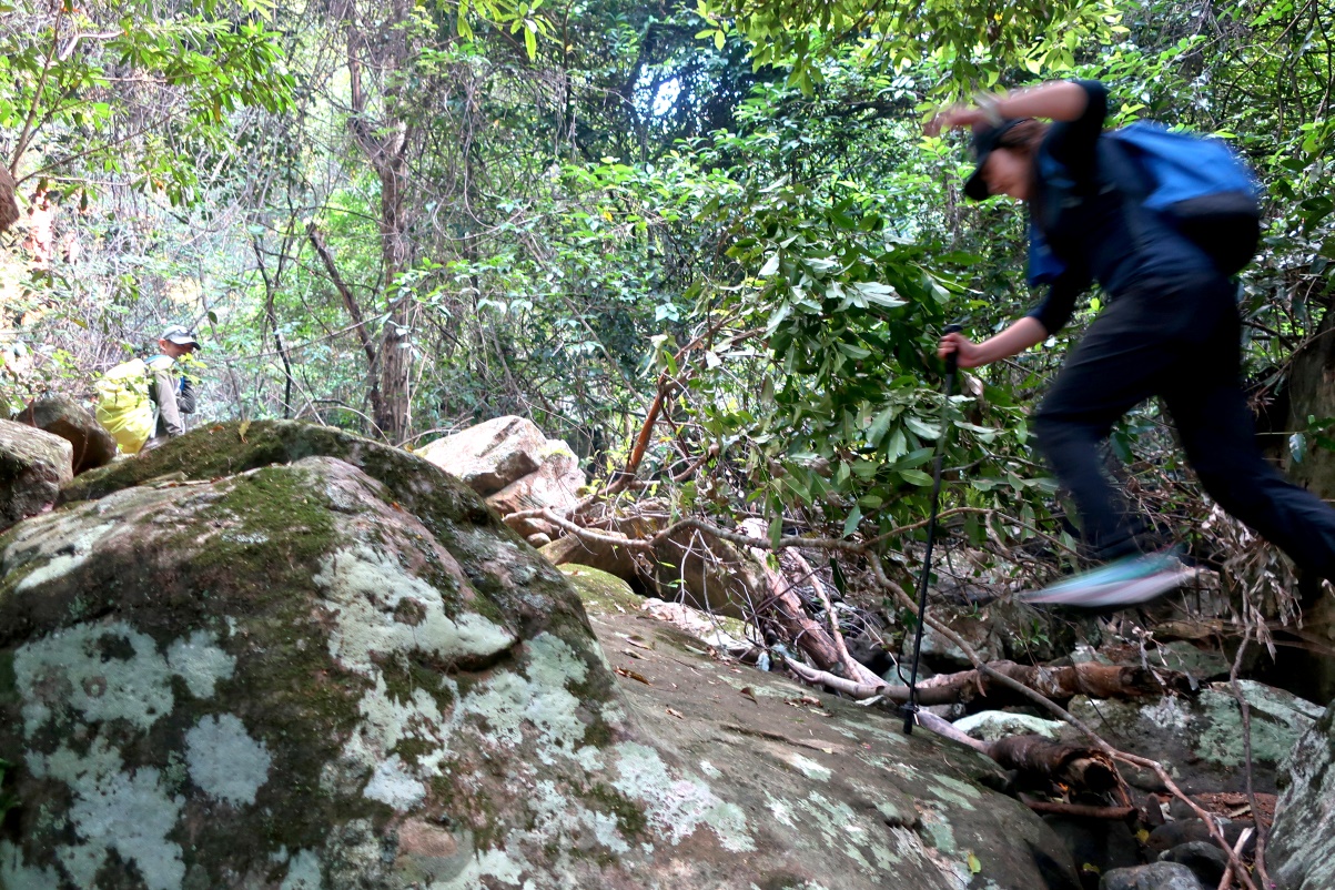
62) Despite her fractured foot (mentioned in the previous pic), Lee can still jump !
Amazing wonder woman !
Waterfall on southern tributary of Stanwell Creek
63) Yus approaching an unnamed waterfall ... the largest and last waterfall along the creek in today's trip.

64) Lee at the unnamed waterfall, GR 127 103

65) Lee at the waterfall ... nice pose ! :-)
To get over the waterfall, climb up a steep slope from beyond the right edge of this pic ... which is what we proceed to do next.
Above waterfall
66) We've climbed up the waterfall.
- Lee is crossing the creek. The waterfall of previous pic is a bit beyond the right edge of this pic.

To top of escarpment
After the waterfall, we could have continued west-south-west, ie along the creek, and attempt to climb up the escarpment that way ... (Scroll back and refer to the pink arrow in map 2.)
For one reason or another, we didn't.
We go south instead.
67) We are attempting to find a way to top of the escarpment ... destination is Coalcliff Dam.
(We'll find a passage in photo #69.)
- Upper pic: Lee bushbashing up the slope
- Lower pic: We are walking along the base of the escarpment ... trying to find a way up the cliff.
• Left to right: Stanley, Lee

68) Stanley at a cave at the base of the escarpment (Photographer: Yus)

69) We found a passage, a steep slope, up the escarpment.
- Upper pic, left to right: Stanley, Lee
- Middle pic: Yus
- Lower pic: Lee, Stanley

Foot track to Coalcliff Dam
70) On foot track to Coalcliff Dam ~~~
- Left to right: Lee, Stanley

Coalcliff Dam spillway
71) At Coalcliff Dam spillway ~~~
- Lower pic: The dam seems to have been decommissioned. This part is all silted up.
Charles Bowden said the dam was used to supply the coal washery at Coalcliff.

72) Coalcliff Dam spillway ... Scene is similar to photo #71's upper pic.
- This pic and the 3 pics in photo #73 form a 360-degree panorama.
- Yellow arrow: Keep going that way is Coalcliff Dam and its dam wall.
- We won't be going to the dam wall today. However, I'll be there 3 weeks later ...
... Refer to photos #46 to #50 in my trip report on Stanwell Creek to Kellys Falls :
http://mntviews.blogspot.com/2020/05/stanwell-creek-to-kellys-falls.html

73) Coalcliff Dam spillway ~~~
- Upper pic: (Continuation from the right of previous pic)
• The small figure is Yus.
• Yellow arrows: Keep going that way is Coalcliff Dam and its dam wall ... We won't be going there today.
• Cyan arrow: Water from the spillway flows in that direction.
It forms Stanwell Creek's southern tributary ... Also refer to photo #74.
- Middle pic: (Continuation from the right of the upper pic)
• Stanley
- Lower pic: (Continuation from the right of the middle pic)
• Lee
- Continuation to the right of the lower pic is photo #72, completing a 360-degree panorama.

74) Water flowing off from Coalcliff Dam spillway ~~~
- This area is near the cyan arrow of photo #73's upper pic.
- If we keep going downstream, we'll reach the waterfall in photos #64 and #65.

Return to car - Forest Walking Track
75) Angophora costata (Sydney Red Gum) ~~~
- Photographed on Forest Walking Track leading towards Wodi Wodi Walking Track
- Left to right: Yus, Stanley, Lee

Return to car - Wodi Wodi Walking Track
76) Wodi Wodi Walking Track ... both pics below are photographed at the same spot ~~~
- Yellow arrows: Direction of walk
- Upper pic: Facing backwards
- Lower pic: Facing forward
• Left to right: Yus, Stanley, Lee

77) An aboriginal woman from the Wodiwodi tribe ~~~
- She is standing by herself on a wooden platform.
- We have a chat. She says this is her land; today is Anzac Day; and so she is standing here to reflect on the effect of European settlement on her tribe :-(

78) Clearing at a diversion from Wodi Wodi Walking Track ~~~
- Seems to be a very good camping site, but it is not marked as such on a map.
- White oval: Senna pendula var. glabrata (Easter Cassia) ... Refer to photo #79.
79) Senna pendula var. glabrata (Easter Cassia) ... yellow flower in the previous pic ~~~
- A native of South America, it was widely cultivated in Australia as a garden ornamental.
- Unfortunately, it has become invasive in eastern parts of Australia, especially along the coast.
- As it is fast growing and can suppress the growth of native species, hence it is declared a weed in NSW & Qld.

80) At the edge of the clearing of photo #78 is a lookout 7 over Illawarra railway line.
Grid Ref: 143 098

81) Tunnel under Illawarra Railway ~~~
- A bit beyond the other end of the tunnel is Lawrence Hargrave Dr, just south of the town of Stanwell Park.
- Upper pic, left to right: Stanley, Lee, Yus
- Lower pic: Photographer: Lee

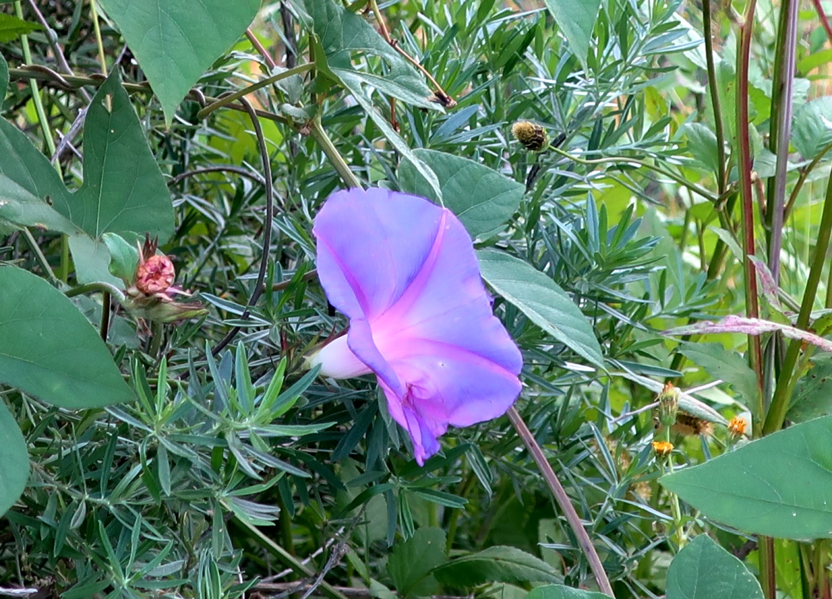
82) Flower photographed between the tunnel of previous pic and Lawrence Hargrave Drive ~~~
- Does anyone know the name of this flower ?
Epilog
This trip is interesting enough.
But 3 weeks later; I'll walk up Stanwell Creek's north arm. That trip turns out to be even more interesting and exciting !
Refer to my trip report on Stanwell Creek to Kellys Falls :
http://mntviews.blogspot.com/2020/05/stanwell-creek-to-kellys-falls.html
No comments:
Post a Comment