Prolog:
The day before, Jeremy, Ricky and I climbed Mt Zeil, highest mountain in NT ... see write up and photos of the trip in http://mntviews.blogspot.com.au/2012/07/zeil-nt-australia.html . This morning, we drop Jeremy at Ellery Creek where he will go on a multi-day hike on the Larapinta Trail back to Alice Springs. Ricky and I continue onto Glen Helen Resort where we'll stay for the night. As we have the afternoon to whittle away, we drive to the nearby Ormiston Gorge to take a look.
Ormiston Gorge and the Pound Walk:
At the Ormiston Gorge Visitor Centre, we come across a 3 to 4-hour circuit walk called the Pound Walk. It is a well defined trail best done in an anti-clockwise direction ... as the visual impact of being confronted with the Ormiston Pound, and then by the Ormiston Gorge is heightened. (The Pound is like a basin, a large flat area surrounded on all sides by hills.)
Trail map ... click on the image to enlarge it.

From the Visitor Centre, the trail meanders gradually up a scenic slope. When you reach the crest, you are suddenly being presented with a bird's eye view of the mind-boggling expanse of the Pound down below. The trail then cuts across the Pound and returns to the Visitor Centre through the stunning Ormiston Gorge, the end of which is a permanent waterhole which you need to wade through.
The Gorge is a part of the Ormiston River which is mostly dry. In the stretch that is part of the trail, it goes through a diverse range of geology ... limestone, granite, sandy patches, stony patches and a section full of purple quartzite.
It only takes us 2 and a half hours to complete the circuit, and it turns out to be one hell of an interesting walk ... it is hell because we need to wade through icy cold water up to our bums ... it is painful !!! ... and memorable !!! ... more on this later in the photos,
If you are around Alice Springs, this Pound Walk has to be at the top of the list of places to go.
Distance:
7.5km for the circuit.
Timeline:
2:30pm Start walk from the Visitor Centre.
3:10pm Side trip to climb a small hill which gives a panoramic view of the Pound.
4:05pm Enter Ormiston Gorge.
4:35pm Ready to cross the permanent waterhole at southern end of the Gorge.
5:05pm Back at the Visitor Centre.
Total: 2 hrs 35 mins; 7.5km
Photos:
1.) Here is the start of the walk. Every few hundred meters or so, a red triangle (like the one in this pic) is nailed to a post. It points the way along the trail.

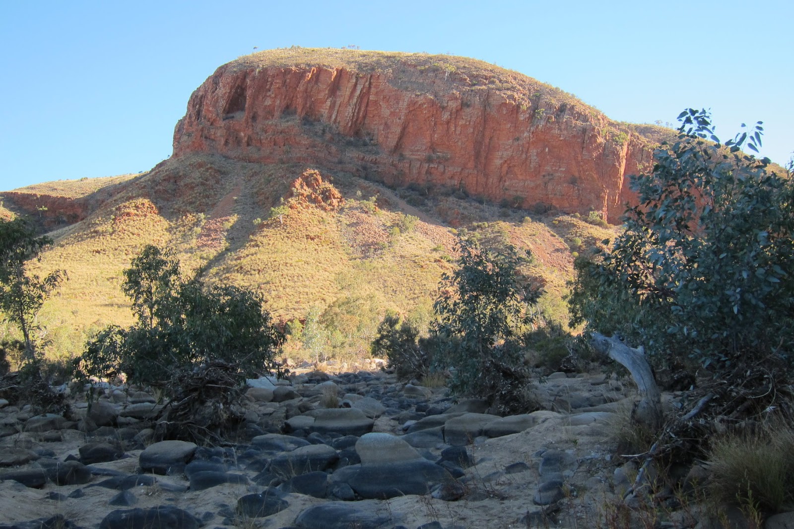
2.) We are heading towards the saddle in the middle of the pic. The Pound is on the other side of the hills.

3.) Ricky - We are getting close to the crest of the saddle.

4.) Upon reaching the crest (see previous photo), we side track to climb up this small hill to get a better view of the Pound.

5.) From the top of the hill is this panoramic view of the Pound which is like a basin, surrounded on all sides by hills.

6.) Walking inside the Pound ... A 360 degree video view is in:
http://www.youtube.com/watch?v=pQBck-TI634

7.) After crossing the Pound, it is on to the dry Ormiston River (this pic) all the way back to the Visitor Centre.

8.) There are sandy stretches in the dry Ormiston River.

9.) Red cliff is a feature in this part of the world - the West Macdonnel Ranges
10.) Entering Ormiston Gorge

11, 12.) Inside the Gorge - love the red cliffs!


13.) Interesting layered formation

14.) These purple rocks are quartzite.

15.) A long stretch of rock steps made of these purple quartzite

16.) Still in the Gorge

17.) We are starting to see some water towards the end of the Gorge.

18.) Need to wade through this permanent waterhole to return to the Visitor Centre.

19.) I'm stripping.

20.) Wading through icy cold water

21.) At night, the temperature around here is below freezing. In the day time, the sun hardly gets through to the bottom of the Gorge. Hence the water here is forever icy cold. I've waded through icy river before, see my Acongua trip in Argentina in http://mntviews.blogspot.com.au/2009/01/2009-jan-argentina-aconcagua.html . There, the water was knee deep. That was bad enough. This time it is up to the bums and a hell lot more dangerous. I can feel the blood almost frozen from the bum down. It takes tremendous effort to get the legs moving. By the time I reach the opposite bank, I can't move the legs anymore. Have to lie on the ground for some time for the surrounding air to warm them up.

22.) I survived to write this blog !!! The wet hair is not from the water. It is sweat from wading through the cold water ... shows how much exertion was required to move the legs. I don't think I have white hair before, but there are white hair now around the ears ... ggrrr!!! :-(
The sand bank jutting into the waterhole is the sand bank in photo #19 where I stripped.

Epilog:
If you like walking through gorges, an even better place to visit is the nearby Mt Razorback. We went there 2 days later ... see my write up and photos in http://mntviews.blogspot.com/2012/07/razorback-nt-australia.html
Hi Mr. Ma, I am a new hiker living in Alice Springs (originally from Bangkok, Thailand) and I was looking for some info and came across your website. I'd just like to let you know that your journals help me a lot and I really appreiciated it. Take care.
ReplyDeleteThanks for your comment, and happy hiking !
Delete