Monday, August 6, 2012

Port Hedland boulders, WA, Australia

2012 August: Boulders at 120km south of Port Hedland, WA, Australia

On the way back to Port Hedland from Karijini National Park, we come across some boulders close by the Great Northern Highway and about 120km south of Port Hedland.  They seem interesting, so we stop the car and walk to the boulders to check them out.

The precise location plus the trail of our walk is in a KML file downloadable from:
  https://docs.google.com/open?id=0B877-h5SCJaSRkh2ZlZObWtyRGs
Its Google Earth screen print is this image: (Click on the image to enlarge it.)


There is a faint 4-wheel-drive track which allows you to drive right to the base of the boulders.  But we park the car at the side of the highway instead as it is only half a kilometer away.

If anyone knows the name of this place, let me know.  It is a certainly an interesting spot, well worth loitering around for a while if you are passing through here.


Elevation:
The highest point of this formation is about 250 meters above sea level.


Time Spent:
This mini excursion takes about 1 hour 45 minutes in total.  Well, no point getting back to Port Heland too early as it is a rather boring town with nothing much to do.


Photos:
1, 2) This is it.  We are walking towards it.


3.) Amongst the boulders now


4.) Same boulder as the previous pic, different angle ... with Grayson and his funny witch hat.


5.) Same boulder as the previous 2 pics, different angle again ... with our shadows taking pictures


6.) Same boulder again! ... with Grayson and his funny witch hat.


7.) As we climb higher, we get a nice view of the flat plain below.  The large boulder is the same one as the previous 4 pics.


8.) Heading to the top of this formation


9.) One of the many boulders


10.) Grayson trying to dislodge the rock ... without success.


11.) At the top of the boulders ... nice scenery of the flat plain below


12.) On returning to the car, I stand on this Great Northern Highway. It is so dead straight that you can easily fall asleep while driving.


Sunday, August 5, 2012

Mt Meharry, WA, Australia

2012 August: Climb Mt Meharry (highest mountain in WA, Australia)

Mt Meharry:
- Highest mountain in WA (Western Australia)
- 1,249 meters in elevation
- In the Pilbara region of WA
- Rarely climbed, being in a remote semi-desert area.

7 down, 1 to go - Now I only have to bag Mt Woodroffe in SA to complete climbing the highest peaks in all 8 Australian States/Territories ... called State-8 peaks ... links to them are given at the end of this account.


MeHurry:
For those who don't know much about Australia, the soil in the Plibara region is extremely rich in iron.  Hence the area is full of iron ore mines.  Most of the extract is shipped to China to fuel its construction boom.  Just as well we climbed Meharry now ... call it MeHurry ... because wait any longer and the entire mountain will be shipped to China by the likes of BHP & Rio Tinto mining companies.


GPX and KML files:
Download them from:
GPX file: https://docs.google.com/open?id=0B877-h5SCJaST25KaFI0eFFoX1k - courtesy of Jeremy
KML file: https://docs.google.com/open?id=0B877-h5SCJaSWGR6b3RqTzliVDQ


Hiking distance and time:
If you park the car like we did at 5.5km from the summit, then the return walk should take less than 4 hours.


Timeline:
09:25  Start walking
11:25  5.5km later, arrive at summit

----- 1 hr 15 min lunch

12:40  Leave summit
14:20  5.5km later, back at our car

----- Total:  Almost 5 hrs (4 hrs 55 min), 11 km

As it is an easy walk on a 4-wheel-drive trail all the way to the summit, hence one should be able to complete the trip much faster than us.  Grayson likes to take videos, which explains the longer time of our walk.


Drive to the base of Meharry:

1)  On the Great Northern Highway, 340 km by car from Port Hedland, you will see a "Juna Downs" road sign pointing to an unsealed road heading towards the west. Turn into this road.  It will lead all the way to the top of Meharry.

The Pilbara is sparsely populated.  There is not a single town between Port Hedland and Newman, a distance of, from the road sign, 340km + 122km = 462km !!!


2)  The following hand drawn sketch map by Jeremy is quite useful (click on image to enlarge it).
Jeremy also sent me this GPX file: https://docs.google.com/open?id=0B877-h5SCJaST25KaFI0eFFoX1k
Load it into your GPS and you will have no problem in finding your way.


3)  The corresponding KML file is: https://docs.google.com/open?id=0B877-h5SCJaSWGR6b3RqTzliVDQ
Display it in Google Earth and you will see the following image.  (Click on the image to enlarge it.)  The yellow line running north-south on the right hand side of the image is the Great Northern Highway.


4)  About 16 km from the Great Northern Highway turnoff, you will come across a T-junction with this sign "Mount Meharry, 4 Wheel Drive Only".
Turn into it.

Wish I own a piece of this dusty red land.  With the iron in it, I would be multi-billionaire by now!!!  

Another 5 km later, you will cross a railway line (refer to image #2 and #3). Don't even think about taking a train to here.  It is a private mining line for iron ore only.

Prior to the crossing, the unsealed road is in very good condition.  After the crossing, the road starts to become rough.

A video of the road not long after the railway crossing is in:

A 2-wheel-drive car can get to within 7 to 10 km of the summit.  But as can be seen from the video, it is safer with a 4-wheel-drive because of the higher clearance between the bottom of the car and the ground.


5)  Typical landscape around this area
(The mountain in front is not Meharry - we won't see it for quite a while.)
We rented the above flat-bed 4WD ute at Port Hedland. Port Hedland is a busy mining port. All other types of 4WD cars have long been rented out by all the fly-in fly-out miners. What was left was this one.


6)  About 5.5km from the Meharry summit, we encounter these metal posts. I was going to keep driving forward by going around them ... but decide to park the car here and walk instead ...


7)  ... Thank God I didn't go around the posts. Had I done it, I would soon plunge the car down this vertical bank into a dry creek !!!
It is possible to drive along side the creek to find a convenient point to cross it.  But on a clear blue sky day like today, why not take a walk instead?


Walk to the summit:

8)  The trail gets quite rough after the dry creek.  Occasionally, a few snappy gum trees (or are they ghost gums?) dotted the landscape here and there, as can be seen from the following photo. With their smooth white trunks, they stand out strikingly against a dusty red landscape.


9)  On the trail, this nearby hill is constantly in sight.  It seems to be splitting into several parts.


10)  At last, we can see the Meharry summit - the highest point in this pic.


At Meharry summit:

11)  Made it to the top!  1,249 meters
According to Jeremy, there is a log book buried somewhere in this cairn.  But I am unable to locate it.


12)  With Grayson


13)  Scenery from the summit ... not bad


14)  The highest peak on the horizon, the far away mountain near the centre of the following photo, is Mt Bruce, 2nd highest mountain in WA. We climbed it yesterday ... check out my write up and photos in:
http://mntviews.blogspot.com.au/2012/08/mt-bruce-wa-australia.html


Return to car:

15)  We have lunch at the summit, then retrace steps to the car which is parked somewhere in the plane below.


360 panoramic view:

A video of 360 panoramic view from the summit is in:


Flowers in Meharry:

There are a number of unique and pretty flowers in Meharry that I haven't seen anywhere else.

16, 17)  This Ptilotus Exaltatus, commonly known as Mulla Mulla, is particularly beautiful.  Native to the arid region of WA, it is an annual herb growing from a few cm to 1.5m high. Its flowers form many pink/purple cones or heads on one plant, making it a showy species, especially when many are found growing together over large areas.


18, 19)  Interesting small red flowers


20, 21)  From a distance, this plant has a dusty and dirty appearance.  But close up, the yellow flowers are quite pretty.


22)  This one with thorns and purple flowers ... Can anyone tell me its name?


23)  Ground hugging flowers ... aren't they pretty !


Camping out in the wild

24)  Mt Meharry is truly remote.  The nearest town is more than 100km away. So we camp out that night in the wild instead.  This site is near Mt Governor, not far from Meharry.


25)  Grayson having fun ... Luckily he didn't set the entire WA's Pilbara region on fire! The humongous torch is made by putting lots spinifex grass on a stick.


State-8 Peaks

Links to the other 6 of the Australian State-8 peaks that I have climbed:

- 2010 Oct, Qld - Mt Bartle Frere
    http://mntviews.blogspot.com.au/2010/08/bartle-frere-queensland-australia.html

- 2011 Jan, ACT - Bimberi Peak
    http://mntviews.blogspot.com.au/2011/01/bimberi-act-australia-east-approach.html

- 2011 Feb, Tas - Mt Ossa
    http://mntviews.blogspot.com.au/2011/02/ossa-tas-australia.html

- 2011 Mar, Vic - Mt Bogong
    http://mntviews.blogspot.com.au/2011/03/bogong-vic-australia-west-peak.html

- 2011 Apr, NSW - Mt Kosciuszko
    http://mntviews.blogspot.com.au/2011/04/kosciuszo-muellers-peak-townsend-nsw.html

- 2012 Jul, NT - Mt Zeil
    http://mntviews.blogspot.com.au/2012/07/zeil-nt-australia.html


Post script !!!:
- 2013 May, climbed Mt Woodroffe in SA
    http://mntviews.blogspot.com.au/2013/05/woodroffe-sa-australia.html
This completes my mission of climbing the highest peak in every Australian States/Territories.

Friday, August 3, 2012

Mt Bruce, WA, Australia

2012 August: Climb Mt Bruce (2nd highest mountain in WA, Australia)

Prologue:
The plane from Perth to Port Hedland was full.  Almost all the passengers were men - flying-in fly-out mining workers ... some were wearing helmets and safety vests with fluorescent stripes ... sort of like business men wearing suits flying out to another city for business deals.  I had the fluke of being seated next to 2 women.  You may think this was lucky.  But they were muscularly built, with faces that looked more like men than women ... made me feel like being suffocated by 2 dominatrices.  Glad when the plane landed at Port Hedland I was able to escape out of their way.

For those who don't know Port Hedland ... it is in the Pilbara region of WA (Western Australia), and is a mining port for the 2 giant mining companies BHP and Rio Tinto.  Jeremy (the guy who climbed Mt Zeil with me last month) was right.  He warned me there is absolutely nothing in Port Hedland, and warned me about its vast expense of flat red dusty plains.  The red earth is rich in iron, good for BHP and Rio Tinto.  But the flatness is a death knell for us mountain baggers.  So, after I met up with Grayson at the airport, picked up a flatbed 4-wheel-drive ute, we were glad to be out of the city and headed for Tom Price, a small town near Karijini National Park, for the night.

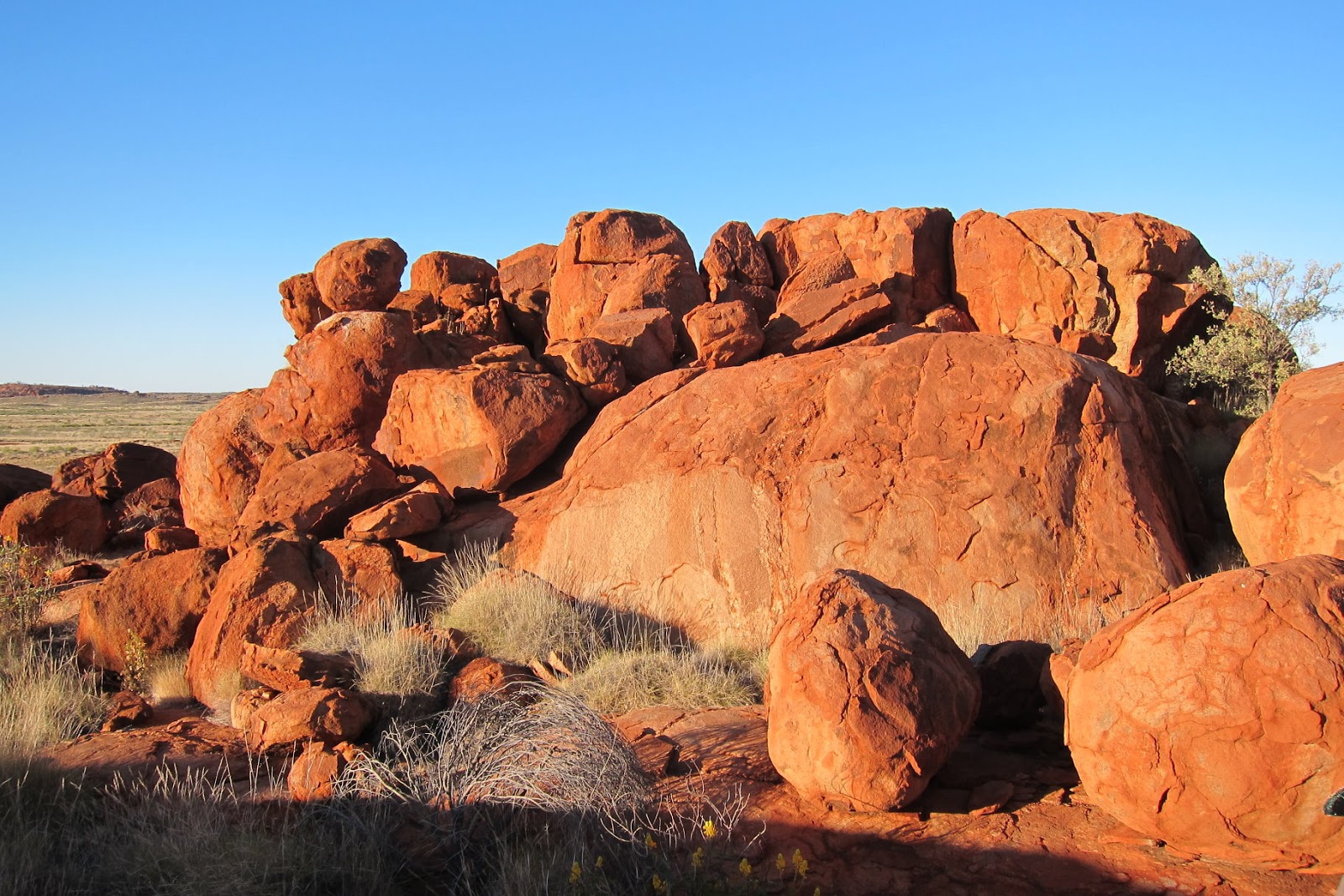
The Pilbara is so sparsely populated that not a single town exists between Port Hedland and Tom Price, a distance of 420km.  On the other hand, we passed a number of mining sites right at the side of the highway.  Judging by the red earth, the whole Pilbara can really be one giant iron ore mine!

The mines seem to operate 24-hrs non-stop ... because we reached Tom Price at 11pm, and along the way, the mines that we passed at night all had lights shining as bright as sunlight with mining vehicles bristling back and forth.

About mining trucks ... many are 4-truck trains (5, if the engine truck is counted).  Some travel at close to 110 km/hr - the road speed limit.  To overtake one of them seems to take forever.  And considering our car was on the wrong side of the road at night during the overtake, it seemed scary.  In fact, it scared the shit out of Grayson.  But we reached Tom Price with all limbs intact and ready to climb Mt Bruce the next day.

Mt Bruce:
- 2nd highest mountain in WA
- 1,234 meters in elevation
- In Karijini National Park
- About 55 km by car from Tom Price to Mt Bruce carpark

Really nice scenery on the walk to the summit ... highly recommended for all hikers.

Map:
On Karijini National Park:
   https://www.alltrails.com/explore/parks/australia/western-australia/karijini-national-park

On Mt Bruce: Download KML file from this site:
   https://docs.google.com/open?id=0B877-h5SCJaSX0c0TVJxTnNvNEU
Then display the file in Google Earth. When in Google Earth, zoom right in and you'll see a well defined walking trail from the carpark all the way to the summit.

1.) The corresponding interactive map is displayed here.  Click on any of the green icons to get its description, or zoom in to see more details (click on the small "+" icon). If you click on the "Sat" icon on top right hand corner, zoom right in and you'll see a well defined walking trail from the carpark all the way to the summit.

View Mt Bruce - place marks in a larger map

Hiking distance and time:
10km hike from Mt Bruce carpark to summit and back.
5hrs 15min of leisurely walk for us, but one should be able to complete the walk much faster.


Timeline:
09:25  Start walking from Mt Bruce carpark
11:35  5km later, arrive at Mt Bruce summit

-----  1hr 15min lunch and explore around the summit

12:50  Leave summit
14:40  5km later, back at carpark


To Mt Bruce carpark:
2.) On the way from Tom Price to Mt Bruce, we parked the car by the side of the highway (Karajini Drive) to take a photo of the mountain.  We rented this flat-bed 4-wheeled-drive ute at Port Hedland.  Port Hedland is a busy mining port.  All other types of 4WD cars have long been rented out by all the fly-in fly-out miners.  What was left was this one.  It was also a manual car ... the last time I drove a manual car was about 25 years ago!  As it turned out, it wasn't too hard to adjust to it.


3.) Mt Bruce.  Don't even think about taking a train to here.  It is a private mining line for iron ore only.


The walk to the Summit:
It is a short walk on a well defined trail to the summit.  Half-a-day should be sufficient for a return trip.  Despite its shortness, it is a very interesting walk as the scenery is first class.  If you are any where near the Karijini National Park, make an effort to climb Mt Bruce ... highly recommended.

Near the foothill of Mt Bruce is Marandoo open pit iron ore mine.  You have a clear view of the mine site along the way to the summit.  When we were there, there was a long train entering the mine.  It is about 2 to 3 km long.  In the Guinness Book of Word Records, the longest train in the world was set on June 21, 2001.  A BHP iron ore train in the Pilbara was 7.353 km long ... see
http://www.youtube.com/watch?v=9LsuNWjRaAo

Along the way to the summit, there is a short section of bare-hand rock climbing, definitely not for the faint hearted.  The rock climb leads to the top of a hill (not Mt Bruce summit) where there are 2 tall cairns built right on the edge of a cliff.  Seems to be the work of a daredevil who had too much spare time with nothing to do.

But the cairns set an interesting background for photographs.

From the hill top, it is not too far to the Mt Bruce summit which is marked by another cairn ... an enormous one ... one of the biggest I have seen on any mountain top!

Photos:
4.) On the walk to Mt Bruce summit, this good-looking conical shaped hill called Chinaman's Hat is constantly in view.


5.) Mt Bruce summit is the highest point in this pic.


6.) Further along the trail ... To reach the Mt Bruce summit, first need to climb up to the top of the hill in the front. As can be seen from the cliffs near the top, some rock climbing is required.  Also if you download the photo and enlarge it, you can just see 2 cairns at the top of the hill ... more on the cairns in photo #11.


7.) Climbing up the hill now ... You can see the chain on the rock face ... it means the climb is getting scary!  The gap between the 2 rock cliffs is where we'll be doing some bare hand rock climbing ...

8.) ... Here is the gap between the 2 rock cliffs of the previous photo. No chain to help you here. The photo doesn't show it ... this is a dangerous climb, as one slip and you'll fall a long way down to the bottom.  An idea of how far you will fall can be gleamed from the next photo.

9.) You can get an indication of how far you will fall if you slip ... a looong looong way down!!!  If you are afraid of height, Mt Bruce is not for you.

10.) In this video, Grayson makes it look so easy.  But you really need to be very careful !


11.) The rock climbing leads to the top of this hill marked by 2 tall cairns.

12.) Reach the top of the hill with the 2 tall cairns (this is not Mt Bruce summit).

13.) Here is one of the cairns.  Both cairns are built right on the cliff edge.  Seems to be the work of a daredevil who had too much spare time with nothing to do.


14.) Nice view looking back ... If you click on the pic to enlarge it, you can see the trail we walked along the ridge top. The hill called Chinaman's hat is at the top right hand corner.  A video of this scene is in http://www.youtube.com/watch?v=WadxNRkmJIs

15.) Mt Bruce summit is not too far ahead.

16.) I am pointing at a cairn marking the summit of Mt Bruce.

17.) At Mt Bruce summit ... one of the biggest cairn I've seen at the top of a mountain.

18.) With Grayson

19, 20, 21.) View from the summit ... The following 3 photos cover 180-degree view towards the east.  A 360-degree video view is in http://www.youtube.com/watch?v=Tq9IBMD1sa0

22.) At Mt Bruce summit ... an interesting gap due to split in a rock

23, 24.) Towards the south is a clear view to the nearby Marandoo iron ore mine.  The iron is shipped to China to fuel its construction boom.  Just as well we have now climbed Mt Bruce.  Wait any longer and the entire mountain will be shipped to China.

25.) Flower of a dwarf Eucalypt (Gum) tree at Mt Bruce summit

360 panoramic view:
A video of 360 panoramic view from the summit of Mt Bruce is in:
http://www.youtube.com/watch?v=Tq9IBMD1sa0

PS:
The next day, we climbed Mt Meharry (WA's highest mountain) in the same Karijini National Park.   A write up and photos of the climb are in my blog:
http://mntviews.blogspot.com/2012/08/meharry-wa-australia.html
Donations are welcome to support the creation of more interesting articles in this blog  :-)

Share