2016 March: Dargan Arch and Friday Canyon in Blue Mountains National Park, NSW, Australia
Prolog
3 of us in today's trip: NC, FM and I
Dargan Arch
Dargan Arch is an arch formed by the collapse of the roof at the rear of a cave many many years ago. The arch is relatively well known to the Blue Mountains bushwalking community, as it is located in the Blue Mountains in the small village of Dargan. What about Friday Canyon?
Friday Canyon
Never heard of Friday Canyon? Haha ! I'm not surprised, as it is only today that we give it its name - Friday being today that we walk through it !
It is a wet canyon at GR 461 934 to 462 935, about 150 meters in length, in an unnamed creek which flows north into the Wollangambe River. The water is not deep, between ankle and knee high.
We've since checked with the heavy weights in the NSW bushwalking community. To the best of their knowledge, no one has passed through it. So we maybe its discoverers. Well, if Michael Keats can give names to all the unnamed places he has visited; and Geoff Fox can give names to all the features in Donkey Mountain; and Peter Cai can name all square rocks as Tofu Ru Rock; we should be entitled to make our mark by naming this canyon "Friday Canyon". It is now done ... documented here in this blog :-)
The location of the canyon is marked on the map showing our route - scroll forward to see the 2nd map.
( Post script:
- The name "Friday Canyon" is now registered in Bush Explorers' website:
http://www.bushexplorers.com.au/encyclopaedia/friday-canyon
- About 1.5 years later in 2017 October, I'll be in Friday Canyon again after returning from Goochs Crater. Photographs & report of the Goochs Crater - Friday Canyon trip are in my blog:
https://mntviews.blogspot.com/2017/10/goochs-crater-friday-canyon-dargan-arch.html )
Maps
LPI 1:100,000 scaled 8931 Wallerawang
LPI 1:25,000 scaled 8931-2S Wollangambe
Below is the relevant part of the 1:25,000 scaled LPI Wollangambe map

GPS tracklog file & Route
The GPX tracklog file of our route can be downloaded from:
https://drive.google.com/file/d/0B877-h5SCJaSWGxISTF0SU1oVkE/view?usp=sharing
Below is our route, red colour, clockwise direction, superimposed on the Wollangambe map:
- The 2 red arrows mark the start and end of Friday Canyon (GR 461 934 to 462 935) in an unnamed creek which flows north into Wollangambe River.
- The blue arrow near the bottom of the map is the start and end of our walk.
- The small red circle along our route and near the centre of the map is the location of Dargan Arch.

Satellite view of our route, clockwise in red colour:

A summary of our route is:
- Park car at GR 458 912, about 45 meters east of Sandham Rd at the village of Dargan
- To Dargan Arch
- To unnamed creek which flows north into the Wollangambe River
- Go through Friday Canyon until we reach Wollangambe River
- Return leg is via track back to Dargan
Timeline & Distance
09:54 0.0 km Start at GR 458 912, about 45 meters east of Sandham Rd at the village of Dargan
10:06 0.3 km On foot trail to Dargan Arch
10:19 1.0 km At Dargan Arch
Explore around
10:28 1.1 km Leave Dargan Arch
10:54 1.6 km Stop for morning tea
Morning Tea
11:07 1.6 km Resume walking
12:12 3.5 km Enter an unnamed creek
12:29 3.7 km Where the creek becomes Friday canyon
12:39 3.9 km Where Friday canyon ends ... back to be a creek
12:44 4.0 km Leave creek
12:48 4.1 km At Wollangambe River
13:04 4.3 km Stop for lunch
Lunch
13:31 4.4 km Start to return to car
13:57 5.5 km At highest point of the local pagodas
13:59 5.5 km Leave highest point of the local pagodas
14:34 7.5 km End at the village of Dargan
==============================================
Total: 4 hrs 40 mins
7.5 km Distance is from Google Earth
9.0 km distance is from Garmin GPS
Pictures - Where our car is parked
1) We take NC's car which is parked here, a few meters to the side of Sandham Rd at Dargan in Blue Mountains National Park, NSW. In retrospect, we should have parked the car further north-west, at the start of the foot trail we will be walking on soon ... see photo #3. Ah, it is always wise after the event :-)

To Dargan Arch
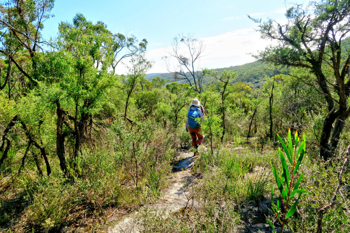
2) Then we bushbash towards north-west. NC leading, followed by FM.

3) Then we hit the foot trail to Dargan Arch. As mentioned already, we should have parked the car at the start of this foot trail. It would save us 12 minutes of unnecessary bushbashing.
Dargan Arch
4) We reach Dargan Arch. The arch is formed by the collapse of the roof at the rear of a cave many many years ago.

5) One can walk over the arch as FM is doing now.

6) One can also go down underneath the arch ... just have to be careful :-)
Left to right: NC FM

7) Under the arch

8) Under the arch

To unnamed creek & Friday Canyon
We now go to an unnamed creek which flows north into the Wollangambe River. Friday Canyon is a section in this creek.
9) A cave near Dargan Arch

10) NC bushbashing towards the unnamed creek

11) Passing by interesting cliffs

12) Pagoda-like rock formations on the other side of a creek (Note: not the creek we'll be walking on soon)

13) Zooming onto the cave on the left side of the above pic

14) Banksias are abound.

15) We are now descending down to the creek where Friday Canyon is located.
The below pics don't show it ... it is a very steep descent. I was mumbling to myself if the canyon turns out to be impassable, it will be a hard job to climb back up again.

Unnamed creek
16) We arrive at the unnamed creek without drama.
Left to right: NC FM

17) Walking downstream towards Wollangambe River ~~~
The water level varies, but not deep, between ankle and knee high.

18) FM & NC

19) Scenery along the creek changes frequently. Sometimes, cliffs are on one side of the creek; sometimes on the other side. In this pic, it is thick vegetation on both sides.

Friday Canyon (GR 461 934 to 462 935)
( More photographs of Friday Canyon are in my 2017 October trip, about 1.5 years later:
https://mntviews.blogspot.com/2017/10/goochs-crater-friday-canyon-dargan-arch.html )
20) After walking along the creek for 17 minutes, 280 meters, we come to a canyon which we name as Friday Canyon. As mentioned already, we maybe the first ones to walk through it !

21) Walking into the canyon and looking back ... In particular, the left pic is looking back at the scene of the previous photo.

22) Walking deeper into the canyon ... quite an interesting place.

23) I need a photo for prosperity :-)

24) Left pic - FM is standing at where I was in the previous pic.
Right pic - NC

Out of Friday Canyon
25) All good thing come to an end ... we are out of Friday Canyon which lasted for 10 minutes, about 150 metres.

Wollangambe River
26) Soon after, we arrive at Wollangambe River.

27) Next is to decide where should we go now. FM & NC are pointing in the direction of Goochs Crater.
The river on the left side of the pic is Wollangambe River ... see previous pic.

28) To go to Goochs Crater, one needs to cross Wollangambe River. It just so happens there is a tree trunk across it. Was the tree fell there on purpose for us hikers?

( However, about 1.5 years later in 2017 October, I make it to Goochs Crater. . Photographs & trip report are in my blog:
https://mntviews.blogspot.com/2017/10/goochs-crater-friday-canyon-dargan-arch.html )
29) As we search for a lunch spot, we pass this large white bag surrounded by sticks. Who put it there? And for what purpose? We remember checking its content. But after the trip, none of us can remember what was inside :-) Geez, the collective lapse in memory makes us look like a bunch of geriatrics. :-)

Lunch by the side of Wollangambe River
30) Found this sunny spot by the side of Wollangambe River, so lunch is on top of these rocks.

31) The lunch spot has a nice panoramic view of the surrounding countryside.
- This pic is towards the north.
- Plenty of pagoda-like rock formations in that direction. But we won't be going there today :-(
- Goochs Crater is behind the spur pointed to by the red arrow and can't be seen from here.
- Between here and the above mentioned spur is Wollangambe River.
- The gap in the middle of the photo and to the right of the red arrow, is a creek running south into the Wollangambe River.

32) FM having a nap ... well it is a nice day and the temperature is perfect for a snooze.

Return to car
33) Lunch over, return to car is via a foot track.

34) Found along the foot track - a Flannel Flower, I think it is Actinotus helianthi.

35) Plenty of burnt out Banksias ... many of the fruiting cones have these weird bright brown patches ... what are they ???

36) An interesting rock

37) We are going to pass through these pagoda-like rock formations.

38) Similar scene as above, but I have no idea why the camera shoots the above pic with a yellow tone and the below one in blue tone. Weird.

Pagoda-like Rock Formations
39) We are now in the pagoda territory.

40) Going through the pagodas

41) Someone's art work with the stones

At highest point of the pagodas
42) We climb to the highest point of the pagodas.

43) Photo time (Photograph courtesy of NC)

44) This photo is the background of the above pic.

45) Continuation to the right of the previous pic

46) The view from the highest point is 360-degree panorama, unobstructed in all directions.

47) Continuation to the right of the previous pic ~~~
FM in this pic and NC in the above pic are are both standing at almost the same spot.

48) This scene is continuation to the right of the previous pic.

Walking through the rest of the pagodas
49) Time to leave ~~~
NC and FM are way ahead, they are almost over the pagoda, because ...

50) ... because I'm busy with taking photos.

51) Catch up with FM

52) Passing through these 2 rock formations

53) More pagodas !

54) Be careful, it is steep.

55) Climbing down these fascinating rock formations

56) The last pagoda, a small one

Return to car
57) Then it is back on the foot track to NC's car at Dargan.

Our timing is perfect ... by the time we reach the car, it starts to rain. And by the time we are out of the local roads and on the main road, the rain develops into a heavy downpour ... so heavy that we can't see through the water on the windscreen. So NC parks the car by the side of the road for a while until the downpour eases. We are glad we weren't caught out in the open with this rain !
Post Script - Goochs Crater
About 1.5 years later, in 2017 October, I'll make it to Goochs Crater. Photographs and trip report are in my blog:
https://mntviews.blogspot.com/2017/10/goochs-crater-friday-canyon-dargan-arch.html
(The return leg will be via Friday Canyon.)
Fabulous day walk! The little canyon was an amazing found. Love reading your blog not because how dramatic the journey was, but because they provide every detail which can be more practical than a guide book.
ReplyDeleteAs for the big white bag, I suspect it's the maintenance material (treated timber, metal pole, concrete, etc.) dropped by National Park authorities - by a helicoptor. I bumped into such things a few times in Morton and Budderoos.
Teddy Wombat,
ReplyDeleteThanks.
We remembered the white bag contained maintenance material, as you said. We just couldn't remember exactly what ... Was it timber? Or other material? One of us couldn't even remember seeing such a bag until a photo was produced :-)
Our memories were horrible :-)