2021 May Day-trip
Mitchells Creek spiked tree to
Rock Pile Pass
Blue Mountains, NSW, Australia
Objective:
- Climb down Narrow Neck cliffs
- Climb down Michells Creek spiked tree
- Climb up Rock Pile Pass
- Cross Corral Swamp back to carpark
Preview
Narrow Neck cliffs

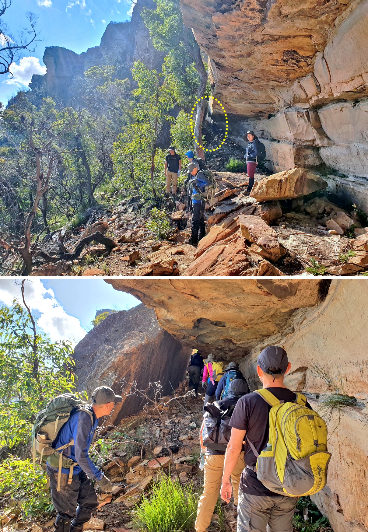
Mitchells Creek spiked tree
A Coachwood (Ceratopetalum apetalum) with a few metal spikes nailed to it trunk.
It is the only way get down to Mitchells Creek around that area.
And not for the faint-hearted !

Rock Pile Pass
Probably the name comes from the rock pile in the yellow oval.

Definitely an exciting and challenging trip in the Blue Mountains Narrow Neck area.
And as shown by the above photographs, an adrenaline junkie would love it :-)
All the more reason you want to do this bushwalk too :-)
You can preview more photos in this link:
https://drive.google.com/file/d/1hb8FxLef3VzPskrbhzuwHKnBOQkK0rKl/view
Our group
7 of us:
Paul ... leading
- CuiJianPing老炊
- Jenny Ye
- Leff (Wei ?)
- Lisa Li
- Lora Ye
- Ming
Prolog
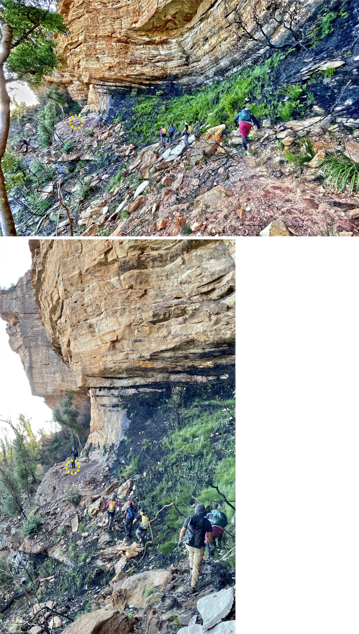
The walk from the bottom of the spike tree to Rock Pile Pass is along a ledge on the west side of Narrow Neck Plateau.
To be successful in finding the Pass, the trick is to walk along the highest ledge whenever possible.
If the climb from a lower ledge to a higher ledge is difficult, still do it.
Or ask an agile member of the group to climb up, and drop a rope down for the rest of the group.
Occasionally, the ledge you walk on may come to an impasse.
Then drop down to a lower ledge and continue on.
But keep your eyes wide open.
At the first available opportunity, climb up to a higher/highest ledge again.
In summary, remember one thing: Whenever possible, walk along the highest ledge.
(Except soon after the spiked tree ...
Walk on the ledge below the highest one, because the highest ledge will come to an impasse.)
Maps
LPI 1:25,000 scaled 8930-2N Jamison and 8930-1S Katoomba
Map 1) The relevant part of the 1:25,000 topographic map:

GPS tracklog file & route
The GPX tracklog file can be downloaded from:
https://drive.google.com/file/d/17qT7EYhx_-b4bnwtfMRYkLbs-uNarnMH/view?usp=sharing
Warning: Due to cliffs, GPS tracklog and Grid Refs in this report may not be accurate !!!
Map 2) GPS tracklog in red is in the following 1:25,000 topographic map:
- Blue arrow: Narrow Neck Plateau locked gate, also start and end of walk, GR 4803 6329
- Pink arrow: Went the wrong way. Who is leading ? ... Sshhh :-)
- 9 brown arrows, top to bottom:
1 GR 4651 6213 Bottom of Rock Pile Pass
2 GR 4644 6211 Bottom of rock climber's rope passage
3 GR 4657 6182 2nd difficult climb
4 GR 4663 6179 1st difficult climb
5 GR 4659 6161 A group of us were stranded here 4 months ago on the night of 2021-01-17.
6 GR 4658 6139 Narrow tunnel/cave
7 GR 4642 6054 Top of fixed rope passage
8 GR 4631 6043 Mitchells Creek spiked tree
9 Mitchells Creek waterfall

Map 3) Satellite image

In summary:
- Park car at Narrow Neck Plateau locked gate, GR 4803 6329.
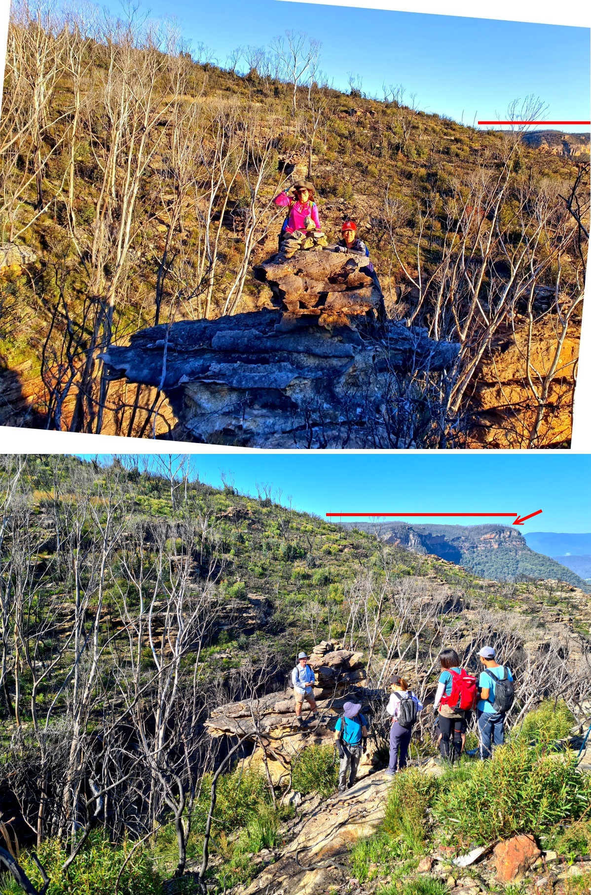
- Walk south on Narrow Neck Plateau Trail.
- Off-track to a rope passage down to Mitchells Creek.
- Cross Mitchells Creek above the waterfall.
- Find the spiked tree on Mitchells Creek west bank.
- Climb down the spiked tree
- Along ledge to Rock Pile Pass.
- Near Rock Pile Pass, climb up a rock climber's rope passage - for the fun of it.
- From Rock Pile Pass, cross Corral Swamp to Narrow Neck Plateau Trail.
- Then back to our cars.
Timeline and Distance
Park cars at GR 4803 6329, a locked gate on Narrow Neck plateau.
07:33 0.0 km Start walking on Narrow Neck Plateau Trail.
08:29 4.1 km Turn right (west) at GR 4662 6049 into a small indistinct foot track towards a rope passage.
08:38 4.38km At top of rope passage, specifically top of the 1st fixed rope, GR 4642 6054.
08:40 4.4 km At top of 2nd fixed rope, GR 4642 6055.
Wait for others to arrive.
08:42 4.4 km Start to climb down the 2nd fixed rope and a set of metal rungs. (I climb down first.)
08:47 4.42km At bottom of rope passage.
Wait for the other 6 to climb down.
08:53 4.45km Resume walking.
09:15 4.73km Crossing Mitchells Creek at GR 4634 6036 (just above the waterfall).
09:31 4.9 km At top of spiked tree, GR 4631 6043.
Wait for others to arrive.
Then I climb down first.
09:35 4.9 km At bottom of spiked tree.
Wait for others to climb down.
Then, together we go to check out the bottom of a waterfall 50 meters to the south.
There, we watch Leff climb up a fallen tree trunk to the mid-level of the waterfall.
Well done, Leff !
10:02 5.1 km From the spiked tree, start walking downstream of Mitchells Creek, aiming for Rock Pile Pass.
11:02 6.02km Stop for morning tea.
Morning tea.
11:17 6.05km Resume walking.
12:16 6.7 km At the southern end of a narrow tunnel/cave.
Grid Ref for this narrow tunnel/cave: GR 4658 6139.
Wait for Lisa & Jenny to go in first, then my turn.
12:20 6.73km At northern end of the narrow tunnel/cave.
Wait for others ... Lora next, then CuiJianPing老炊, Leff, Ming.
12:27 6.77km Resume walking.
12:59 7.1 km GR 4659 6161 where a group of us were stranded for the night of 2021-01-17.
Lunch
13:32 7.2 km Resume walking.
13:33 7.25km GR 4662 6165 where a group of us were winched up to a rescue helicopter
on the morning of 2021-02-18.
13:37 7.25km Resume walking.
13:46 7.4 km 1st difficult climb, GR 4663 6179 (instead of keep going along the ledge).
2 ropes are used ... Refer to photos #55, #56, #57.
14:25 7.43km I have climbed up the ropes.
Wait for Jenny & Ming to climb up.
Then for CuiJianPing老炊 to pack up the ropes.
Then climb up a weeny bit more to a ledge.
14:32 7.45km Resume walking ... keep going along ledge.
14:38 7.53km 2nd difficult climb, GR 4657 6182 (instead of keep going along the ledge).
One by one, we climb up.
14:58 7.6 km Resume walking.
15:23 8.05km At bottom of rock climbers' rope passage, GR 4644 6211.
15:24 8.05km Resume walking towards Rock Pile Pass. (We'll be back here at 15:34.)
15:27 8.1 km At bottom of Rock Pile Pass, GR 4651 6213.
Leave backpacks here.
15:32 8.15km Leave Rock Pile Pass to return to the bottom of rock climbers' rope passage.
15:34 8.20km Back at bottom of rock climbers' rope passage (same spot as at 15:23).
15:41 8.23km At top of passage.
Wait for Leff & Ming to climb up.
15:43 8.25km Resume walking; go towards Rock Pile Pass along top of the cliffs.
16:00 8.42km At top of Rock Pile Pass.
We climb down and up Rock Pile Pass, for the fun of it :-)
And more importantly, to retrieve our backpacks which were left behind at 15:27.
16:13 8.44km Leave top of Rock Pile Pass.
16:52 9.12km On a foot track (we had been bushbashing before then.)
16:59 9.6 km On Narrow Neck Plateau Trail.
17.29 12.1 km Back at our cars.
==============================================
Total: 9 hrs 56 mins
12.1 km Distance is from Google Earth
Pictures - Locked gate & carpark, Narrow Neck Plateau Trail
Location: GR 4803 6329
1) Locked gate and carpark on Narrow Neck Plateau Trail ~~~
- White arrow: Sign at locked gate.
The words are: EMERGENCY ACCESS
DO NOT BLOCK ROAD
- Lower pic: Group photo (Photographer: Leff)
• Left to right: 1 Ming, 2 Lora, 3 Jenny, 4 Lisa, 5 Paul, 6 CuiJianPing老炊

2) Near cliff edge by the side of the carpark (Photographer: Leff) ~~~
- Ming knows he is going to enjoy an adrenaline-filled trip :-)
- 2 red arrows, left to right: Megalong Head, Mt Elphinstone ... north-north-west

Narrow Neck Plateau Trail
3) Cliffs along Narrow Neck Plateau Trail ~~~
- Yellow arrow: Direction of walk
- White oval in both pics below: They circle the same cliff.

4) View towards Megalong Valley ~~~
(Centred towards north-west ... After 35 minutes of walking on Narrow Neck Plateau Trail)
The fog will lift by lunch time.
- 4 red arrows, left to right:
1 Hargreaves Trig of Panorama Point
2 Hargraves Lookout (of Panorama Point) at end of Shipley Road
On the map, why is it "Hargreaves" Trig & "Hargraves" Lookout ???
3 Mt Tosh
4 Mt Kitosh
- Left to right: Jenny, Lisa, Leff

5) View of where we'll be going ~~~
- Yellow arrows: Our route for the next 2 and a half hours
- Cyan arrow: Mitchells Creek

6) Mt Solitary from Narrow Neck Plateau Trail ~~~
- Upper pic:
• Left to right: CuiJianPing老炊, Lora
• Horizontal bar: Mt Solitary
• Red arrow: The Col of Mt Solitary
- Lower pic: Further along Narrow Neck Plateau Trail
• Horizontal bar: Mt Solitary
• Red arrow: The Col of Mt Solitary
• This pic and the 3 pics in photo #7 form a 360-degree panorama.

7) Panorama from Narrow Neck Plateau Trail ~~~
- Yellow arrows in the 3 pics below: Direction of walk
- Upper pic: (Continuation from the right of previous pic)
• Left to right: CuiJianPing老炊, Jenny
• Red oval: Fools Paradise
- Middle pic: (Continuation from the right of the upper pic)
• Towards Megalong Valley ... similar scene as photo #4
• Left to right: Ming, Lisa
- Lower pic: (Continuation from the right of the middle pic)
• Facing backwards and centred towards north
- Continuation to the right of the lower pic is photo #6's lower pic, completing a 360-degree panorama.

8) If weather is not foggy, you'll see this instead (Photo taken in an earlier trip) ~~~
- Upper pic:
• Yellow arrow: Direction of walk on Narrow Neck Plateau Trail
- Middle pic: (Continuation from the right of the upper pic)
• Towards Megalong Valley
• Red oval: Fools Paradise
- Lower pic: (Continuation from the right of the middle pic)
• Yellow arrow: Direction of walk
• 4 red arrows, left to right:
1 Hargreaves Trig of Panorama Point
2 Hargraves Lookout (of Panorama Point) at end of Shipley Road
On the map, why is it "Hargreaves" Trig & "Hargraves" Lookout ???
3 Mt Tosh
4 Mt Kitosh

Off-track to fixed ropes
9) At GR 4662 6049, turn right (west) to the fixed-ropes passage ~~~
- Yellow arrow: Follow a narrow indistinct foot track to the fixed ropes.
- Red oval: Fools Paradise
- Upper pic: Junction of the indistinct foot track with Narrow Neck Plateau Trail (Photo taken in an earlier trip)
- Lower pic: A little further into the foot track compared with the upper pic

1st fixed rope
The 1st fixed rope was not here 4 months ago in 2021-01.
Wonder who install it since ?
Bushwalkers ?
For what purpose ?
To reach the spiked tree at Mitchells Creek ???
10) At top of the 1st fixed rope, GR 4642 6054 ~~~
It is the start of a steep descent down the cliff.
It is slippery as well as steep even though it doesn't look so in the pic below.
- Yellow arrow: Direction of walk
- White oval: 1st fixed rope ends at this tree.
2nd fixed rope starts at the same tree ... Refer to photo #11.

2nd fixed rope
11) Looking back at the fixed ropes ~~~
- Left to right:
• Jenny holding the 1st fixed rope.
• Lora is further back.
- White oval: It is the same tree as previous pic's white oval.
2nd fixed rope is anchored to this tree.
- Yellow arrow: Direction of walk

12) Looking back at the 2nd fixed rope ~~~
- White oval: The rope is anchored to this tree.
It is the same tree as previous pic's white oval.
- 3 ladies, left to right:
1 Jenny ... holding the rope
2 Lora ... at where Jenny was in the previous pic
3 Lisa ... further back
- Yellow arrow: Direction of walk

13) Facing forward at the same rope ~~~
- Yellow arrows: Direction of walk
- Lower pic, left to right: Lora, Lisa (Photographer: CuiJianPing老炊)

14) The 2nd fixed rope continues at where Lora was in the previous pic ~~~
- Yellow arrow: Direction of walk

15) The rope continues ~~~
- Paul, 1st to go down (Photographer: Jenny)
16) Along the rope ~~~
- Left pic, top to bottom: Lisa, Lora (Photographer: Jenny)
- Right pic: Jenny

17) Along the rope, left to right: CuiJianPing老炊, Lisa, Lora, Jenny.
- Above the rope is Leff (between CuiJianPing老炊 and Lisa).

18) Along the rope ~~~
- Left pic, top to bottom: CuiJianPing老炊, Lisa (Photographer: Jenny)
- Right pic: Lisa, Lora (Photographer: CuiJianPing老炊)
Lisa has no sense of gravity.
It is illegal in NSW to use a mobile phone while driving.
The same law should apply here :-)

19) End of the 2nd fixed rope is set of metal rungs ~~~
- Left to right: Ming, CuiJianPing老炊, Lisa

20) Down the metal rungs, top to bottom: CuiJianPing老炊, Lisa.

To upstream of a waterfall on Mitchells Creek
21) An indistinct foot track ... immediately after climbing down the cliff of previous pic ~~~
- Yellow arrow: Direction of walk
Follow the foot track for a little bit.
Then turn left to walk along a ledge, heading to a spot just upstream of a waterfall on Mitchells Creek.

22) (Looking back) We are walking along a ledge towards a spot just upstream of a waterfall on Mitchells Creek ~~~
- Yellow arrows: Direction of walk

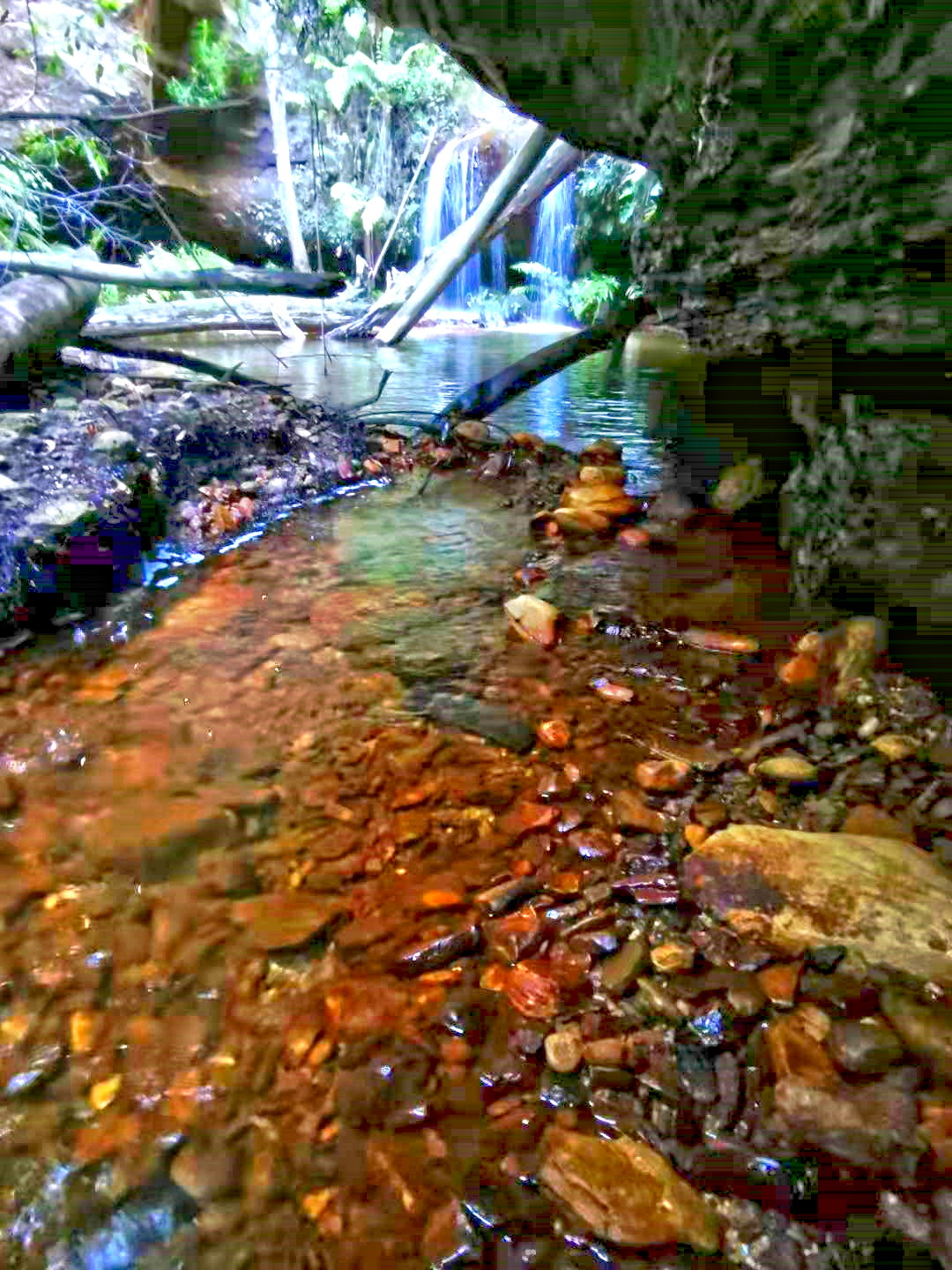
Above Mitchells Creek waterfall
Location: GR 4634 6036, just upstream of the waterfall.
23) Lisa crossing the creek (from east to west) ~~~
- Cyan arrow: Mitchells Creek, direction of flow

Mitchells Creek spiked tree
Location: GR 4631 6043
After crossing Mitchells Creek, bushbash downstream (northward) along the west side of the creek.
Soon, about 80 meters as the crow flies, we come to the infamous spiked tree, a Coachwood (Ceratopetalum apetalum) with a few metal spikes nailed to it trunk.
If you are a first timer, it is not easy to find the tree from the cliff top. So keep your eyes wide open !
It is the only way get down to Mitchells Creek around this area.
And not for the faint-hearted !
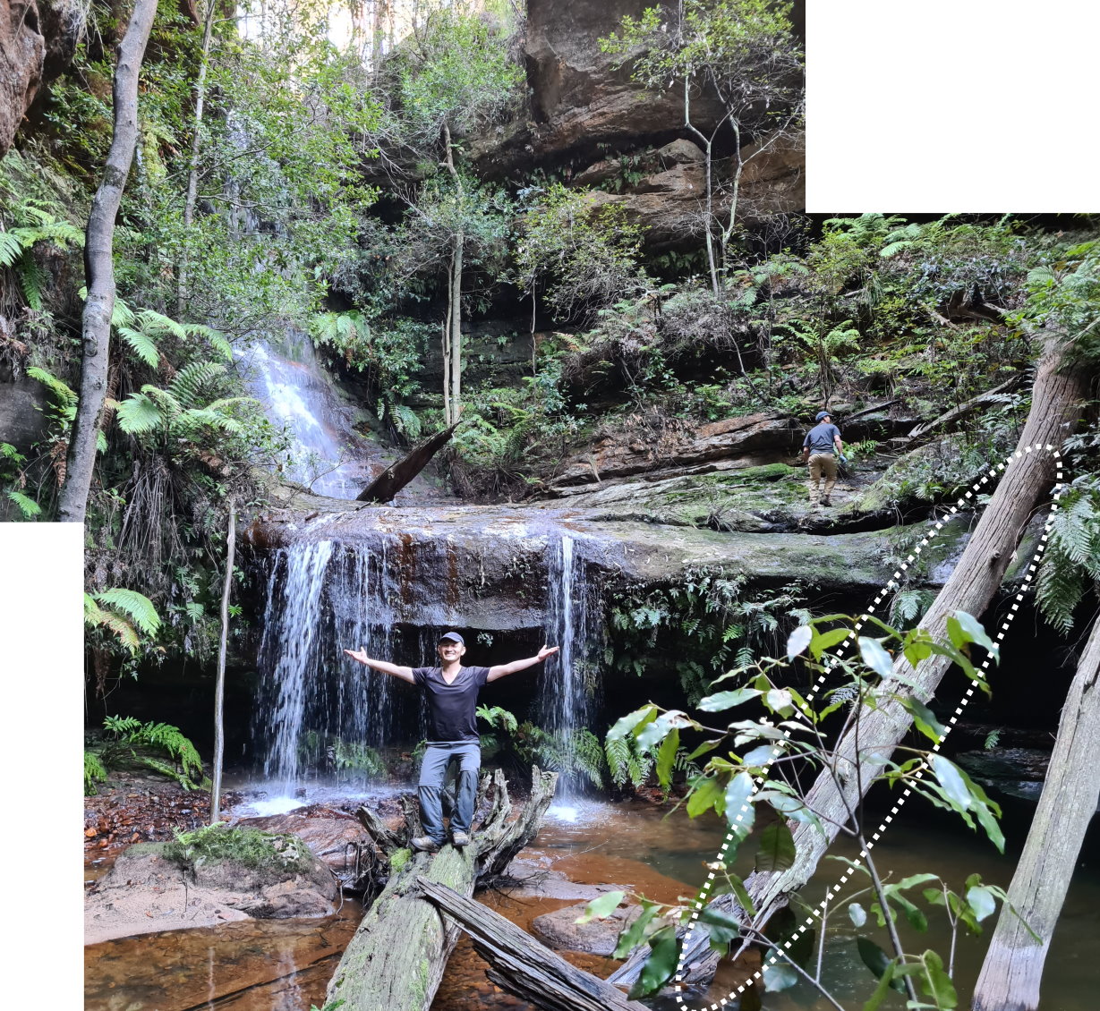
24) The spiked tree ~~~
- White circle in both pics below: The top spikes
- Lower pic: Paul (Photographer: Lisa)
• Cyan arrow: Mitchells Creek

25) Looking down the spiked tree.

26) Paul ... first to climb down (Photographer: CuiJianPing老炊) ~~~
- Cyan arrow: Mitchells Creek

27) Lisa climbing down, watched by Jenny at the cliff edge.

28) Lora climbing down (Photographer: CuiJianPing老炊) ~~~
- Right pic: Paul, Jenny, Lisa ... watching Lora

29) Lora climbing down, watched by CuiJianPing老炊.

Mitchells Creek waterfall
We leave our backpacks at the bottom of the spiked tree ...
30) ... Then go to take a look of the waterfall (Photographer: Ming) ~~~
From the spike tree, walk south/upstream. Soon, we come to this scene.
31) Mitchells Creek waterfall (Photographer: Lisa) ~~~
- Jenny

32) Mitchells Creek waterfall ~~~
- Leff is the only one who climbs up ... no mean feat !!!
- Watched & photographed by Lisa.

33) Leff tries to find another way back down to the creek ~~~
No ... there is no other way down except back down the log (white oval) again :-)
- Left to right: Ming, Leff
Along ledge to Rock Pile Pass - 1
After visiting the waterfall, retrace steps back to the spiked tree.
Then walk northward along the ledges on the east side of Mitchells Creek towards Rock Pile Pass.
To be successful in finding Rock Pile Pass, the trick is to walk along the highest ledge whenever possible.
If the climb from a lower ledge to a higher ledge is difficult, still do it.
Or ask an agile member of the group to climb up, and drop a rope down for the rest of the group.
Occasionally, the ledge you walk on may come to an impasse.
Then drop down to a lower ledge and continue northward.
But keep your eyes wide open, at the fist available opportunity, climb up to a higher/highest ledge again.
In summary, remember one thing: Whenever possible, walk along the highest ledge.
(Except soon after the spiked tree ...
Walk on the ledge below the highest one, because the highest ledge will come to an impasse.)
34) Along a ledge (Photographer: Jenny) ~~~
- Left to right: Lisa, Paul, Lora

35) Along the ledge ~~~
- Lora in front, followed by Ming, Jenny, CuiJianPing老炊

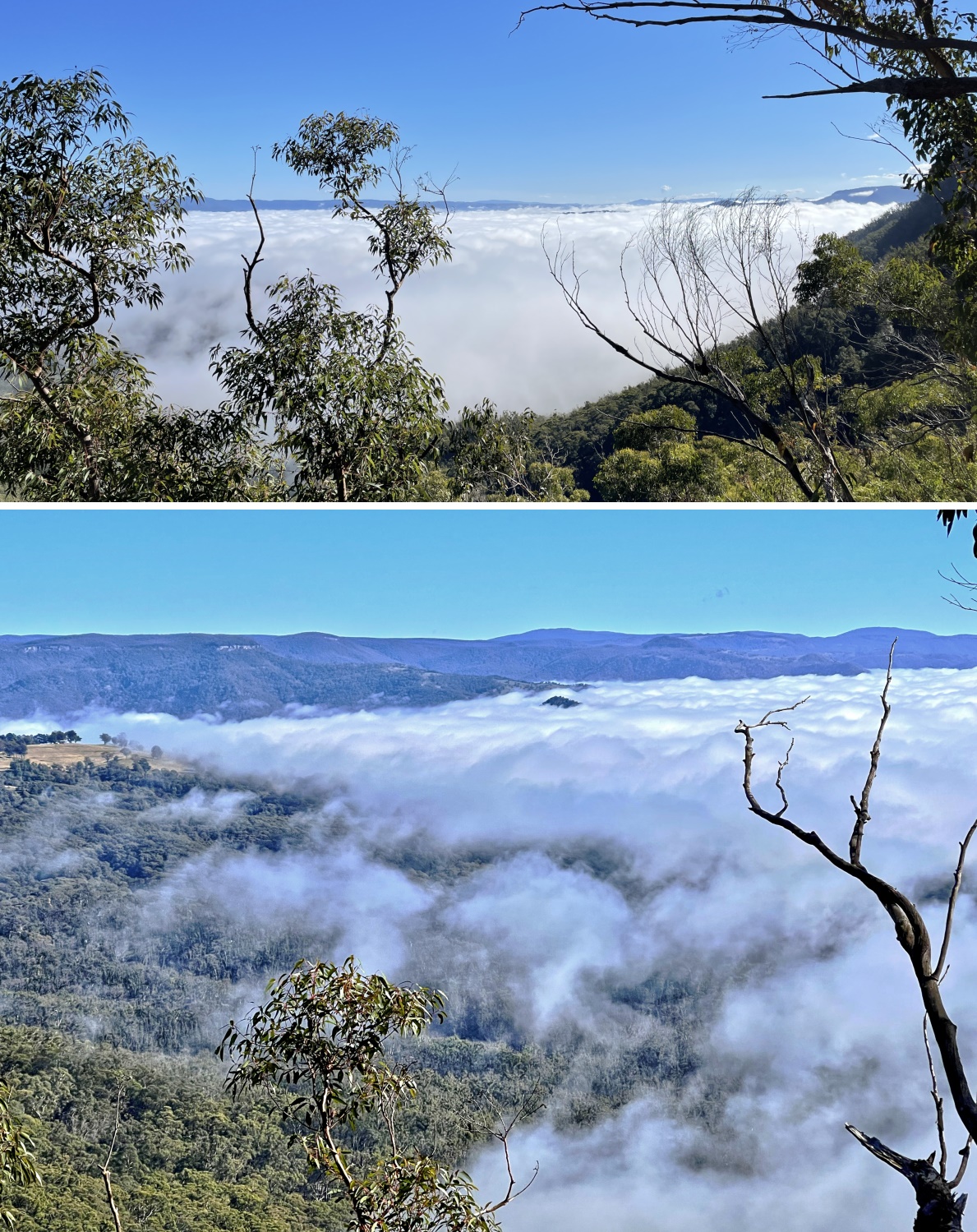
36) Megalong Valley shrouded in mist ... The mist will lift soon.
37) A mushroom almost engulfing a tree branch ... an unusual sight.

38) A car, dumped here for a long time.

39) Along the ledge ... be careful ! (Photographer: CuiJianPing老炊) ~~~
- Upper pic, left to right: Jenny, Ming
- Lower pic: Ming, Leff

40) A skinny spiked tree without the spikes :-) ~~~
We were on a ledge that had come to an impasse. Hence climbing down now to a lower ledge.
We could have retraced our steps back a bit, then find a way down. But this way is faster.
- Lora & CuiJianPing老炊 watching Paul sliding down.

41) Along the ledge (Photographer: CuiJianPing老炊) ~~~
- Left to right: Lora, Leff, Paul, Jenny

42) Along the ledge (Photographer: CuiJianPing老炊) ~~~
- Upper pic, left to right: 1 Jenny, 2 Lisa, 3 Lora, 4 Ming, 5 Leff
- Lower pic, left to right: 1 Paul, 2 Lisa, 3 Jenny, 4 Lora, 5 Leff, 6 Ming
(I can't remember whether this ledge will go through.
Not to worry, as mentioned earlier, if the ledge doesn't go, then retrace steps back to bit.
Find a way down to a lower ledge, then continue forward.
At the first opportunity, climb up to a higher ledge even if the climb is difficult.)

Through a narrow tunnel/cave
Location: GR: 4658 6139
43) Through a tunnel/cave along the ledge ~~~
- Lisa
- Yellow arrows: Direction of walk ... Inside the tunnel/cave, the direction turns left.
It is wider at the entrance. Once you turn left, it becomes extremely narrow !

44) After turning left (refer to previous pic), the tunnel/cave becomes extremely narrow ~~~
Even with backpacks off, it is a struggle to squeeze through ... just ask Jenny :-)
- Left pic: Facing forward
• Jenny in front; Lisa is further into the tunnel/cave.
- Right pic: Facing backward at Lora
(Photographer: Jenny ... She has squeezed through the tunnel/cave !)

45) Facing backward ~~~
- Lisa (white circle) taking a photograph of Jenny taking a photograph of Lora

Along ledge to Rock Pile Pass - 2
46) More walking along the ledge ... facing backwards at Lisa (Photographer: Jenny).

47) And more climbing up to a higher ledge. (Photographer: CuiJianPing老炊) ~~~
- Left to right: Jenny, Lisa

48) More walking along the ledge (Photographer: CuiJianPing老炊) ~~~
- Left to right: Lisa, Lora, Leff

A group of us were stranded & rescued here 4 months ago
49) We have lunch here, GR 4659 6161 ~~~
This is also where a group of us were stranded 4 months ago on the night of 2021-01-17.
(That is another story ... Will write up a trip report one day.
And none of the people in that group wants to come with me today ... ha ha ha !)
- Back row, left to right: 1 Leff, 2 Lisa, 3 Jenny, 4 Lora, 5 CuiJianPing老炊
- Ming is nearest to the camera.

50) Another photograph of us at the lunch spot (Photographer: Ming, using Jenny's phone) ~~~
- Standing at the back: Jenny
- Others, left to right; 1 Lisa, 2 Leff, 3 CuiJianPing老炊, 4 Lora, 5 Paul
- My backpack is on the right edge.
51) GR 4662 6165, about 50 meters north of our lunch area of previous pic ~~~
Here, a rescue helicopter winched up a group of us 4 months ago in the morning of 2021-01-18.
(We were stranded for the night of 2021-01-17 ... Refer to photos #49, #50.)
- Upper pic: Picture taken today
- Lower pic: Picture taken 4 months ago
• 4 people, left to right: rescuer, Huang Lee, rescuer, rescuer
- Cyan ovals in both pics: They circle the same brown tree.
- White ovals in both pics: They circle the same stone.

52) Panning to the left of previous pic (and facing backwards) ~~~
- White ovals in both pics below: They circle the same feature.
- Upper pic: Picture taken today
• Yellow arrow: Direction of walk
- Lower pic: Picture taken 4 months ago in the morning of 2021-01-18
• Left to right: WenSheng Liu, rescuer, rescuer

53) Facing forward (Pictures taken by Lisa around the same area as previous pic) ~~~
- Upper pic, yellow oval: A short tunnel ... Refer to lower pic.
• Left to right: Leff, Paul, CuiJianPing老炊, Lora
- Lower pic: About to go through the short tunnel
• On the left: CuiJianPing老炊
• On the right: Paul leading, followed by Jenny, Lora, Leff, Ming
Along ledge to Rock Pile Pass - 3
54) After the tunnel of previous pic, we come to this area. (Photographer: Lisa) ~~~
Here, 4 months ago in the morning of 2021-01-18, Yusin Mulia and I collected some water for our group.
- Paul

1st difficult climb
Location: GR 4663 6179
To reach Rock Pile Pass, here comes the 1st of two difficult climbs.
If you don't climb up here, you can keep going along the ledge.
In about 160 meters (??? not sure; but soon), you get another chance to climb up.
It will also be a difficult climb.
And it is possible you may miss that spot.
And so, better to climb up here now.
55) 1st difficult climb ~~~
- Looks easy, but not so ! ... Just ask Lora :-)
- CuiJianPing老炊 climbs up first, then sets up his rope for us.

56) This is where CuiJianPing老炊's rope is anchored ~~~
- Left to right: Jenny, CuiJianPing老炊

57) Besides the blue rope (white arrow), CuiJianPing老炊 also asks Lisa to set up the orange rope.
The orange rope is not necessary, but it helps as the slope is steeeep.
- Left to right: Jenny, Ming, CuiJianPing老炊

58) A lovely Blandfordia cunninghamii (Christmas Bells) ~~~
Near where the orange rope is anchored ... just beyond the bottom-left corner of previous pic.
(Blandfordia cunninghamii grows in damp shallow soil, often near cliffs.
It is only found in the Blue Mountains and on Mt Kembla in the Illawarra region of NSW.
Flowering appears to be indirectly stimulated by rainfall and by bushfire the previous summer.)

2nd difficult climb
Location: GR 4657 6182
After the 1st difficult climb, walk along the ledge for about 6 minutes / 80 meters, we come to the 2nd (and last) difficult climb.
It is easy to miss this spot. So keep your eyes wide open.
Although if you miss it and keep going along the ledge, you'll soon find the ledge comes to vertical drop.
Not to worry, just retrace the steps back to here :-)
59) The 2nd (and last) difficult climb ~~~
CuiJianPing老炊 climbs up first. He sets a rope for us.
- Left to right:
1 Lora ... She climbs up with the assistance of a rope.
For reason I don't understand, I can't see the rope here. (But it is in photo #60.)
2 Lisa (most of her is blocked by Lora)
3 CuiJianPing老炊

60) Lora (upper pic) and Jenny (lower pic) climbing up (Photographer: Lisa) ~~~
- The rope was set up by CuiJianPing老炊.

Along ledge to Rock Pile Pass - 4
After the 2nd difficult climb, the rest is easy ... just keep walking along the ledge.
61) The majestic cliffs of Narrow Neck Plateau ~~~
Above these cliffs is Corral Swamp.

The above scene is repeated in photos #62 and #63.
62) Same scene in the 2 pics below (Photographer: CuiJianPing老炊) ~~~
- Yellow circle: Photo #63 is taken from there.
- Paul (leading), followed by Jenny, Lisa, Ming, Lora. Plus Leff in the lower pic.
63) At the yellow circle of previous pic, I took this picture of our group ~~~
- Jenny leading, followed by Lisa, Ming, Lora, Leff, CuiJianPing老炊

64) Our group at the yellow circle of photo #62 (Photographer: CuiJianPing老炊) ~~~
- Left to right: 1 Lisa, 2 Jenny, 3 Leff, 4 Ming, 5 Lora

65) 180-degree panorama from the ledge ~~~
- Upper pic: Lora (Photographer: CuiJianPing老炊)
• Red arrow: Black Billy Head
• White oval: Fools Paradise
• Cyan arrows: Mitchells Creek
• Yellow arrows: We walked on top of the cliff to Mitchells Creek.
Then along the ledge all the way to where we are now.
- Middle pic: (Continuation from the right of the upper pic)
• Red arrow: Black Billy Head
- Lower pic: (Continuation from the right of the middle pic)
• Left side of the pic: Megalong Valley
• Yellow arrow: Direction of walk along the ledge

We haven't seen a single soul since we started walking at 7:30am ...
66) ... Seeing these rock climbers, we know we are close to civilization :-)
- 3 people on the ground, left to right: Jenny, Leff, rock climber

67) Zooming into the rock climber of previous pic.
Rock climbers' rope passage
Location: GR 4644 6211 for the bottom of the passage
68) Close to Rock Pile Pass is this rock climbers' rope passage.

For the time being, we'll skip the above rock climbers' passage.
Instead, we'll go to Rock Pile Pass first.
Leave our backpacks there.
Then return to here.
Rock Pile Pass
69) I'm at Rock Pile Pass, looking down at our group climbing up the gully towards me.
- Left to right: 1 Lisa, 2 Ming, 3 Leff, 4 Lora, 5 CuiJianPing老炊, 6 Jenny

70) Rock Pile Pass (yellow oval) is behind the bunch of trees.
- Lower pic: (Photographer: Lisa)
• Left to right: 1 CuiJianPing老炊, 2 Leff, 3 Ming, 4 Paul (higher up), 5 Jenny

71) This is it ... Rock Pile Pass, GR 4651 6213.
The pass is probably named from the pile of rocks (yellow oval) at the bottom of the cliff.

One of the objective of this bushwalk is to climb up the above Rock Pile Pass.
We could have done it now.
Instead:
- We leave our backpacks here, return to the rock climbers' rope passage of photo #68.
- Climb up there.
- Walk around top of the cliffs to top of Rock Pile Pass.
- Then climb down the pass to retrieve our backpacks.
Rock climbers' rope passage - again
After dropping our backpacks at the bottom Rock Pile Pass (photo #71), we are back at Rock climbers' rope passage of photo #68.
72) Lora leading the charge to climb up the passage.
- Below her is Lisa.

73) Lora
- Upper pic: (Photographers: Lisa)
- Lower pic: (Photographer: CuiJianPing老炊)

74) Continue climbing up rock climbers' rope passage ~~~
- Top to bottom: Lora, Lisa, Jenny (Photographer: CuiJianPing老炊, upper pic)

75) From top of the rope passage, looking down (Photographer: Lisa) ~~~
- Top to bottom: 1 Jenny, 2 CuiJianPing老炊, 3 Paul, 4 Ming, 5 Leff

76) We've all climbed up. Now on the cliff edge above the rope passage. (Photographer: CuiJianPing老炊) ~~~
- Left to right: Lora & Lisa taking photographs
- White oval: Redledge cottage in Redledge Reserve ... north-west-ish

77) View over Megalong Valley from the cliff edge above the rope passage ~~~
- White oval: Redledge cottage in Redledge Reserve ... north-west-ish
- Upper pic: Leff
- Middle pic: Left half of the upper pic
- Lower pic: Right half of the upper pic

To Rock Pile Pass
From top of rock climbers' rope passage, we head towards the top of Rock Pile Pass.
78) To Rock Pile Pass ... the scrub is not too bad to walk through ~~~
- Upper pic: (Continuation from the right of previous pic)
- Lower pic: (Continuation from the right of the upper pic)
• White oval: Rock Pile Pass ... Can't be seen clearly through the scrub.
• Yellow arrow: Direction of walk

79) Scrambling down towards Rock Pile Pass below (Photographer: Lisa) ~~~
The slope is of loose mud/sand/stone ... steep and slippery.
Somewhere around here, Jenny slipped and was about to tumble down the slope.
Saved in the last minute by CuiJianPing老炊 grabbing onto her :-)
- In both pics below:
• Leff is nearest to the camera.
• Further away, left to right: 1 Jenny, 2 Ming (blocked by tree), 3 Lora, 4 CuiJianPing老炊, 5 Paul

80) Crawling through a low overhang to Rock Pile Pass ~~~
- Upper pic: Lora's leg
• Yellow arrows: To Rock Pile Pass ... Crawl through here.
- Lower pic: (Continuation from the right of the upper pic)

81) Looking back at the same overhang as photo #80's upper pic (Photographer: Lisa) ~~~
- Left to right:
• Jenny ... crawling through
• CuiJianPing老炊 ... He is at roughly where Lora was in photo #80's upper pic.

Rock Pile Pass - again
After crawling through the low overhang of previous pic, we are at top of Rock Pile Pass.
(Photo #71 is the bottom of Rock Pile Pass. We left our backpacks there.)
82) We climb down Rock Pile Pass to retrieve our backpacks ~~~
- Upper pic: Lisa climbing down
- Lower pic: Lisa has climbed down (Photographer: CuiJianPing老炊)
• The other 3, left to right: Paul, Leff, Lora

83) Lora climbing down ~~~
- Yellow oval: Rock Pile Pass probably gets its name from this rock pile.

84) We then climb back up :-) (Photographer: Lora) ~~~
- Paul ... My inelegant way of climbing up Rock Pile Pass
- Yellow oval: Rock Pile Pass probably gets its name from this rock pile.

85) I don't have any photographs of our group climbing up the pass today ~~~
Below are 2 pictures of Lily Han in a bushwalk from Rock Pile Pass to Diamond Head Pass 3 months ago 2021-02-28.
Her climbing stype is more elegant than mine :-)
- Yellow oval: Rock Pile Pass probably gets its name from this rock pile.
- Upper pic: Lily Han climbing up
- Lower pic, top to bottom: Yusrin Mulia, Lily Han

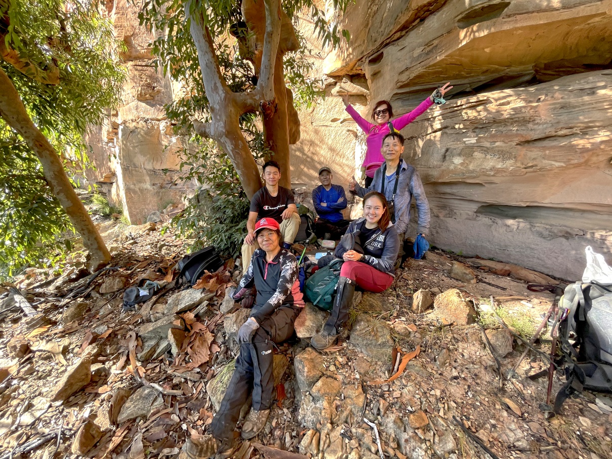
86) Group photo at top of Rock Pile Pass (Photographer: CuiJianPing老炊) ~~~
Well done everyone ! This is not an easy trip !
- Left to right: 1 Jenny, 2 Ming, 3 Leff, 4 Lisa, 5 Lora, 6 Paul

Corral Swamp
From Rock Pile Pass, we crawl back out of the overhang of photo #81.
Then climb back up the steep slippery slope of photo #79 to reach the Corral Swamp plateau.
87) Cliff edge of Corral Swamp plateau ~~~
- Upper pic:
• Left to right: Jenny, Lisa ... top of a rock
• Red bar: Fools Paradise
- Lower pic: Same scene 3 months ago 2021-02-28, in a bushwalk from Rock Pile Pass to Diamond Head Pass
• Left to right: 1 John Graham, 2 iSunny, 3 ZCC/Anna, 4 Lily Han, 5 Stanley Wu
• Red bar: Fools Paradise
• Red arrow: Black Billy Head
88) At another cliff edge of Corral Swamp plateau ~~~
(Picture taken near where the previous pic was taken)
- Lora
- Red bar: Fools Paradise
- Red arrow: Black Billy Head
- Right half of the pic: Megalong Valley
- Black rocks at bottom-right corner: Part of Corral Swamp

89) Walking on Corral Swamp towards Narrow Neck Plateau Trail ~~~
- Top to bottom: CuiJianPing老炊, Jenny

90) Scenery from Corral Swamp (Photographer: CuiJianPing老炊) ~~~
- Left to right: 1 Ming, 2 Leff, 3 Paul, 4 Jenny, 5 Lisa
- Red bar: Fools Paradise
- 2 red arrows, left to right:
1 Roughly where we climbed down to Mitchells Creek
(Exact spot is blocked by the ridge in the foreground.)
2 Black Billy Head

91) We found a foot track on Corral Swamp. The foot track will lead us to Narrow Neck Plateau Trail ~~~
- Left to right: Ming, Lora, Lisa, Jenny

Narrow Neck Plateau Trail
92) On Narrow Neck Plateau Trail back to our cars ~~~
- Upper pic, left to right: Lisa, Jenny, CuiJianPing老炊
- Lower pic: (Photographer: CuiJianPing老炊)
• Far away, left to right: Ming, Leff, Lora
• Others: Lisa, Jenny, Paul

Dinner in Wentworthville
After the walk, back at Sydney, dinner is in a restaurant in Wentworthville.
The commuter carpark near Wentworthville Railway Station is where we all meet up in the morning for today's car pool.
93) Nice fish :-) ~~~
- Lower pic: (Photographer: Jenny)

Comment
Sunset: 5:02pm
Last light: 5:30pm
We reached our cars at 5:29pm.
Can't have a better timing than this !
Definitely an exciting and challenging trip in the Blue Mountains Narrow Neck area.
You really should put this one in your bucket list !
Other bushwalks in this part of Narrow Neck area
1) 2020 June, 11 months ago
Redledge Pass to Mitchells Creek spiked tree ... One for your bucket list :-)
https://drive.google.com/file/d/164o7-sV4LkogSPnJ4yqqePp7_qYrN-bq/view
Though not as challenging as today's trip, but well worth doing ...
... Because it is climbing up the spiked tree
which is a totally different adrenaline-filled experience compared to climbing down the tree today.
2) 2021 January, 4 months ago
Mitchells Creek spiked tree, and failed attempt to find Rock Pile Pass
It ended with a helicopter rescue :-)
https://drive.google.com/file/d/1Kbr1O3SAzPL3IQ0tt8HygWJ5dXcO ODnY/view?usp=sharing
3) 2021 February, 3 months ago
Rock Pile Pass to Diamond Head Pass
https://drive.google.com/file/d/1gU3ZNSUPahqDAY2oBS4OhY-o--1Wu0Hv/view
Great report Paul, I read through it word by word and occationally checked Google Map. Feeling like myself just done the trip with you guys, phew!
ReplyDeleteThank you !
DeleteYou may like to organize a trip with Ray, Grace, Karen and others one day :-)