2024-September
Day-trip ... bushwalk to:
- Natural Bridge Cascade aka
Barkala Falls
- Warratah Falls (detour)
Blue Mountains, NSW, Australia
PDF version
If you prefer ...
A slightly shorter PDF report of the trip is
in this link:
https://drive.google.com/file/d/1ySq_Fwa5nPhA0gZWv24Nc9FvH9S8aAOj/view
Otherwise, read on ...
Preview
Natural Bridge Cascade aka Barkala Falls
Notice something different ?
Water gushing out of a hole 2 metres
below the top !
- From John Kennett's video

At the top of the fall
Water flowing down this hole.

Prolog
I was intrigued by this waterfall
from John Kennett's video, 2024-May-14.
Refer to this link:
https://www.instagram.com/p/DChrOrVi08b
John Kennett is from
SBW (Sydney Bush Walkers) bushwalking club.
He had also written an article in the
2024-February issue of the SBW magazine ...
This link:
https://drive.google.com/file/d/1vltCaAMlgZ0m_ngdWGWzd_MQWe8s_Mkp/view
(page 4)
By the way, this trip is not so easy.
Look at my white shirt at the end of the day:
https://www.instagram.com/reel/DAnIXrGCWJC
😭
Our group
5 of us:
Paul - leader
John Graham
Lyndal Tegel
Grace Fang
Robyn Skanda
On the return leg, John bushbashed in the front,
making life much easier for the rest of us 😊
Thank you, John Graham !
Topographic map
1:25,000 scaled 8930-1N Mount Wilson

Trailhead
Trailhead is at a locked gate.
Grid Ref: 6505 8661
Refer to the map below.
It is at the end of an access road (unsealed),
off Bells Line of Roads.
There is a small carpark by the locked gate.
GPS tracklog file & route
GPX tracklog file is in this link:
https://drive.google.com/file/d/1jT6UHLfBo2tvgQfhImQNSwYCzJ2CrlmU/view
The tracklog (in red) superimposed
on the topographic map:
- 4 blue arrows, left to right:
1 Grid Ref 6505 8661
Park car here, in front of a locked gate.
2 Grid Ref 6514 8626
Waratah Falls, a small waterfall
3 Grid Ref 6558 8610
Small rock platform
where we have morning tea
4 Grid Ref 6777 8601
Natural Bridge Cascade aka Barkala Falls
- 2 blue ovals, left to right:
1 An unnamed small canyon, photo #83
We walk above it, not in it.
2 Large rock platform, photos #18 - #29

Post script ...
Left blue oval of above:
In 2025 February 22,
Amy Chi and I walked inside the unnamed canyon.
Nothing specially interesting there.
Satellite image.
The icons are the same as previous map.

In summary:
- Park car at the trailhead.
Grid Ref: 6505 8661
- First, to Waratah Falls, a small waterfall.
- Then to a not-interesting small rock platform.
- Next, to an interesting large rock platform.
- Down to Hungerfords Creek.
- Then up Barkala Gully to the falls.
- Return leg is roughly the same.
ie Initially to Hungerfords Creek.
- Then to the large rock platform.
- Skip the small rock platform.
- Return to car via a ridge upstream of
Waratah Falls.
Timeline & Distances
Park Lyndal's car at trailhead.
Grid Ref: 6505 8661
08:04 0.00km Start walking
08:07 0.05km Off-track detour to here
to see some waratahs
08:08 0.05km Resume walking ...
towards foot-track
08:28 0.9 km GR 6514 8626 Waratah Falls
08:33 0.99km Leave Waratah Falls
08:38 1.16km GR 6529 8640
where we'll go off-track
Explore around for the best way to go off-track.
08:42 1.26km Go off-track now
09:12 1.87km GR 6558 8610 small rock platform
Morning tea
09:24 1.92km Resume walking
10:01 2.8 km At a large rock platform
10:22 3.23km Leave large rock platform
11:23 4.43km At junction of
Nungarood & Hungerfords Creeks
12:07 5.26km At junction of
Hungerfords Creek & Barkala Gully
12:27 5.55km At Natural Bridge Cascade
aka Barkala Falls
Lunch
Explore top and mid-level of the falls
13:54 6.38km Leave Natural Bridge Cascade aka
Barkala Falls
14:08 6.6 km At junction of
Barkala Gully & Hungerfords Creek
14:37 7.32km At junction of
Hungerfords & Nungarood Creeks
15:45 8.45km Stop for a rest
Rest
15:48 8.45km Resume walking
15:50 8.56km At large rock platform
15:58 8.9 km Leave large rock platform
17:23 11.03km Back at Lyndal's car
Total:
9 hours 19 minutes
11.03 km Distance is from Google Earth
Pictures - Waratahs at the trailhead
1) Telopea speciosissima (Waratah).
- Back row, left to right: Robyn, Grace, Paul
- Front: Lyndal
Photo by John Graham

2) Telopea speciosissima (Waratah).
- At the trailhead.
Photo by John Graham

Waratah Falls
Grid Ref: 6514 8626
3) Detour to Waratah Falls, a small waterfall.
- Left to right: John, Lyndal, Grace

4) Along this ledge to Waratah Falls.
- Paul leading, followed by John, Lyndal, Grace
Photo by Robyn

5) Why does Waratah Falls have a railing ?
- John

6) Why does this small waterfall have a railing ?
It must have been a popular fall in the past.
- Left to right: John, Grace

7) Paul.
(The next pic is taken by me from this position.)
Photo by John Graham

8) The plunge pool.
(Photo taken from where I was in the prev pic)
- Robyn
- Colour of the pool is dirty dark grey.
Doesn’t look inviting 😭

9) Why does this small fall have a railing ?
- Left to right:
Paul, John, Lyndal (blocked by tree), Grace
Photo by Robyn
From where she was in previous pic
From where she was in previous pic

10) Another look at Waratah Falls
and its uninviting plunge pool.

Bushbashing
11) We go off-track here.
- 2 horizontal arrows:
Way to the above small waterfall
- Downward slanting arrow:
Off-track bushbash now
(to a small rock platform)

12) The bushbash isn't bad 😊
- Left to right: Lyndal, Robyn, Grace, John

Small rock platform
We come to a small rock platform.
Grid Ref: 6777 8601
There is nothing special about this place.
You are better off not wasting time to come here.
Go directly to the large rock platform instead ...
photos #18 - #29.
13) Morning tea.
- John, Lyndal

More bushbashing
14) After morning tea, more bushbash ...
To a large rock platform.
- Grace, Lyndal
- John ... further ahead

15) John, Lyndal, Robyn.
Photo by Grace

16) Come to a patch of ground
with Only knee-high grass, hardly any shrub.
- Unusual !

17) Group photo at same area as previous pic.
- Left to right: John, Robyn, Lyndal, Grace

Large rock platform
We come to a large rock platform.
It is worth a bushwalking trip just to come here
to marvel at this expansive area !
18) The large rock platform.

19) A step or two forward compared to prev pic.
- John, Lyndal, Robyn

20) The large rock platform.
- Lyndal, Grace, Robyn

21) John.

22) John ... the small figure.

23) A patch of moss on the rock platform.
- Looks like Australia 😊

24) Some patterns on the rock platform.

Edge of the rock platform
25) Interesting pattern ...
On the edge of the rock platform.

26) On the edge of the rock platform.
- Left to right: John, Lyndal, Robyn, Paul.
- White oval: Refer to photo #27.
Photo by Grace

27) This rock is in the white oval of previous pic.

28) Still on the edge of the rock platform.
- Robyn, Grace, John, Lyndal
- White oval: A small arch ... Refer to photo #29.

29) Small arch in the white oval
is the one in the previous pic.
- Clockwise from bottom:
Robyn, John, Lyndal, Paul
Photo by Grace

Down to Hungerfords Creek
30) Bushbashing down to Hungerfords Creek.
- Top to bottom: Lyndal, Grace, Robyn

Hungerfords Creek
31) Bushbashing along the banks of
Hungerfords Creek.
- Lyndal, Robyn.

32) Bushbashing and bushbashing.

33) Along the banks of Hungerfords Creek.
- Top to bottom: Grace, Lyndal

34) Obstacles.
- Robyn

35) Looking back at the same obstacle
as previous pic.
- It is a bit nasty to get through here.
- Lyndal, Grace

36) Hungerfords Creek.

37) How did this tyre get to such a remote place ?
If it was washed down from the cliffs above,
shouldn't it to be snagged much further
up the slope ?
Where was “Clean Up Australia” ? 😊

38) Hungerfords Creek.
- John. (Robyn is in front of him.)

39) Hungerfords Creek.

40) Hungerfords Creek
- John.

41) Hungerfords Creek.
- Paul, Robyn
Photo by Grace

42) Hungerfords Creek.

43) Hungerfords Creek.

44) Hungerfords Creek.
- John

Barkala Gully
From Hungerfords Creek,
turn north (left) into Barkala Gully.
The main waterfall for this trip is in this gully.
45) Now in a creek that flows in Barkala Gully.
- In the official NSW topographic map,
why isn’t the creek named Barkala Creek ?
- Robyn

46) Very close to the main waterfall.
- Follow the yellow arrows.

47) Same cascade as previous pic.
- White arrow: Grace
We’ll climb up to where Grace is,
from a bit beyond the right of this pic.

48) Same cascade as previous 2 pics.
- Yellow arrow: Where Robyn (and I) will climb up.

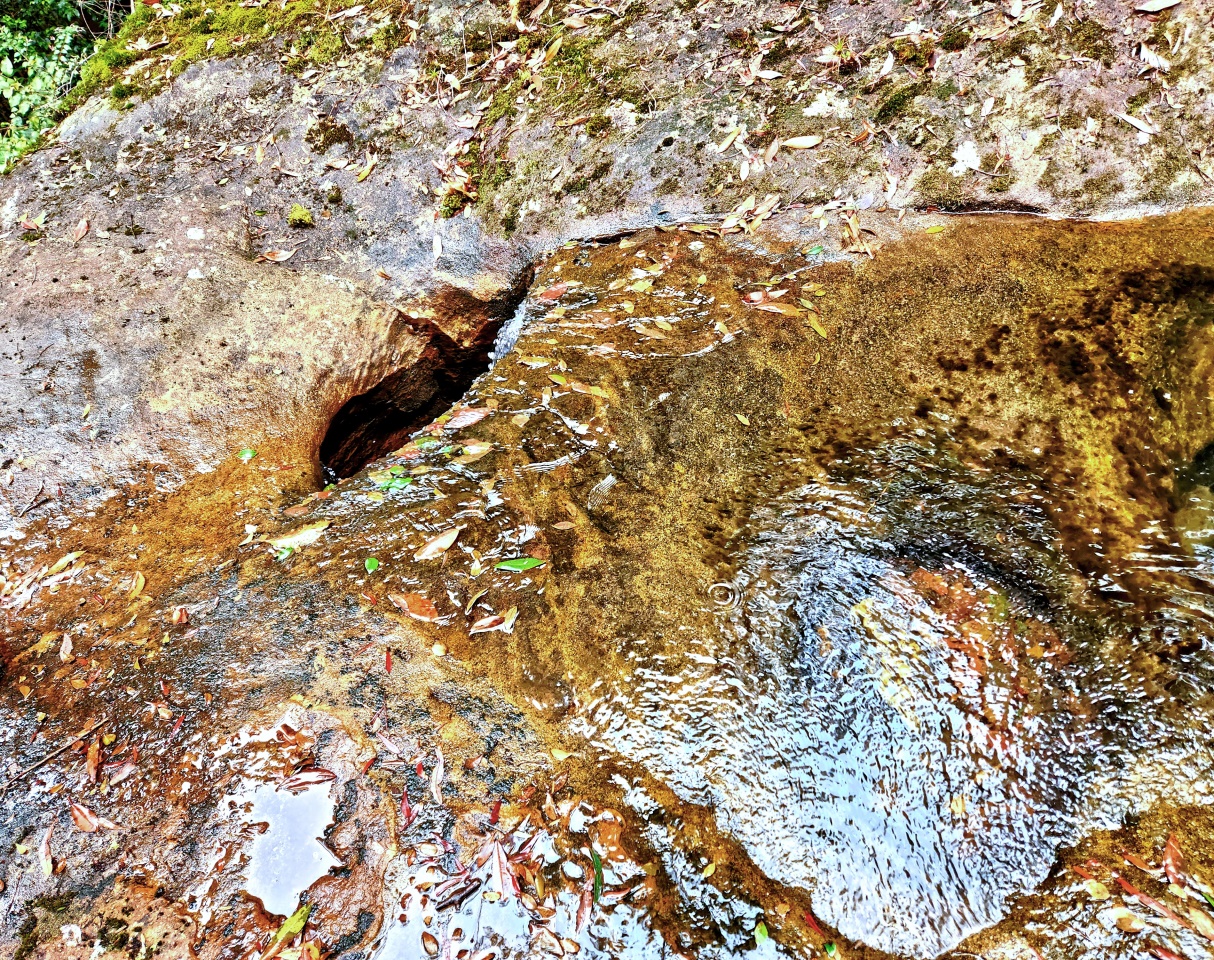
Natural Bridge Cascade
Natural Bridge Cascade, aka Barkala Falls.
Made it here after 4 hours & 15 minutes
of walking.
49) This waterfall is different from others
because of water gushing out of a hole !
- Robyn, Grace

50) Same waterfall ...
Photo by John Kennett,
4 months ago, 2024-May-14.
- Compared to previous pic,
a lot more water 4 months ago.

51) Natural Bridge Cascade, aka Barkala Falls.
Later, we’ll climb to the top from the right.
Then down to the ledge on the left to the hole.

52) Lyndal.
Photo by John Graham

53) Grace.

54) Lyndal.
Photo by John Graham

55) A final look at the hole in the waterfall.

56) Grace.
- She intends to go behind the waterfall soon ...
next pic 😊

57) From behind the waters.
- John, Lyndal, Robyn, Paul
Photo by Grace

58) Same scene as previous pic,
this time, in front of the waters.
- Clockwise from bottom:
Grace, Lyndal, John, Robyn.

Top of the waterfall
We climb up to top of the falls from the right.
59) Group photo: John, Lyndal, Grace, Paul, Robyn
Photo by John Graham

60) Another look at the hole
where water gushes out.
We’ll be at the hole in photos #71 - #77.
- Group photo: John, Lyndal, Grace, Paul, Robyn
Photo by John Graham

61) At top of the waterfall, facing upstream.

62) After hopping over the main boulder
of previous pic.

63) Facing where the water falls down the cliff.
- Grace, Robyn, John
- Red arrow: Hole where water falls through.
You can’t see the hole in this pic.
It is blocked by John’s bum 😊
- Red dot: Robyn is sitting here in photos
#59, #60, #64.

64) Robyn at the red dot of previous pic.
- She is also at the same spot
in photos #59 and #60.

65) Still at the top of the waterfall.
- 2 red arrows:
1 John's legs
2 Water flows down this hole.
Photo by John Graham

66) Yours truly and the hole.
- Grace is at the left edge.
Photo by Robyn

67) The hole.
- Cliff edge is at top-left corner.
68) Water flowing down the hole.
- Cliff edge is at top-left corner.
- Upper-left: Robyn
- Lower-left: Lyndal

69) Water flowing down the hole.

Hole where water gushes out
70) John leads us down one level
to where water gushes out of the other end.
- Refer to the yellow arrows in photo #51.

71) This is where the water gushes out !
- John
Photo by John Graham

72) Calm down ! Calm down !
For safety, a rope is tied to Robyn's waist.
Photo by John Graham

73) Robyn.
Photo by John Graham

74) Robyn, relishing at this special moment ! 😊
Photo by John Graham

75) Robyn and the hole from a different angle.
- Red oval: Rope tied to Robyn
(She is safe from being swept
down the fall.)

76) Lyndal.

77) Grace.

78) Looking down the fall.

This is the end of our adventure.
We now retrace our steps back to the cars.
The return leg
79) Passing a small overhang / cave.
- John is leading; followed by Robyn, Lyndal, Grace

80) The small overhang / cave of previous pic.
- It is cracking 😭

81a) Dillwynia retorta.
(Eggs and Bacon ... what a funny name !)
- Here, they are prolific, carpeting a large area !
- John

81b) Dillwynia retorta.
(Eggs and Bacon ... what a funny name !)

82) A boot-like rock.
- Very small compared to
Mercurys Boot in Ben Bullen SF

Unnamed creek/canyon
John leads us back to our car via a ridge
above an unnamed creek upstream of
Waratah Falls (photos #5 to #10).
83) We are now above an unnamed creek.
- It looks like an interesting canyon down below.
Mental note to self ...
Must explore this canyon one day !

Post script:
In 2025 February 22,
Amy Chi and I walked inside the unnamed canyon.
Nothing specially interesting there.
Back at the carpark
84) Usually, I wear a white shirt.
Advantage:
One can gauge the difficulty of a bushwalk
by how dirty the shirt is.
Judging by the condition of my shirt now,
this trip is not easy 😊
- Paul, Robyn
Photo by Grace

85) Part of my white shirt 😊
From Robyn’s video

Comments
1) Natural Bridge Cascade aka Barkala Falls
may not be the most exciting waterfall.
But it is definitely interesting,
due to the hole near the top where water flows out.
2) The small rock platform (photo #13)
is not interesting.
Suggest you don't waste time going there.
No comments:
Post a Comment